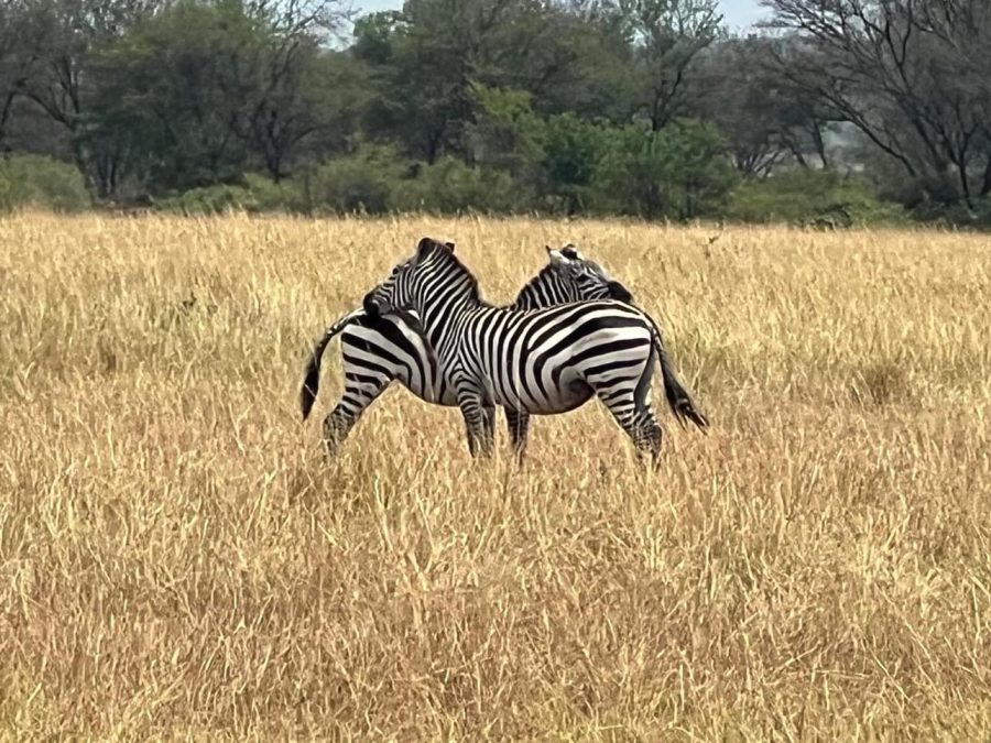
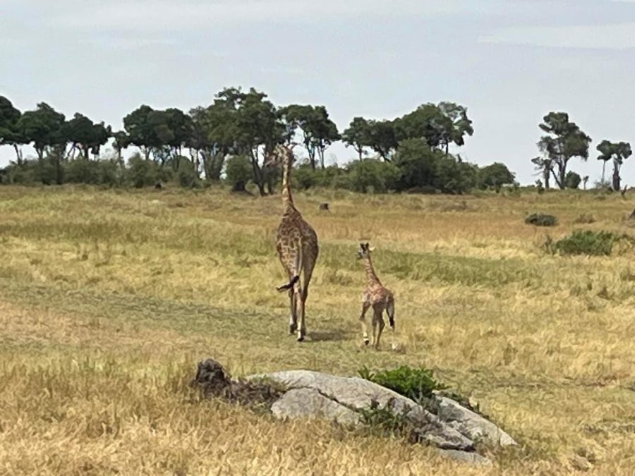
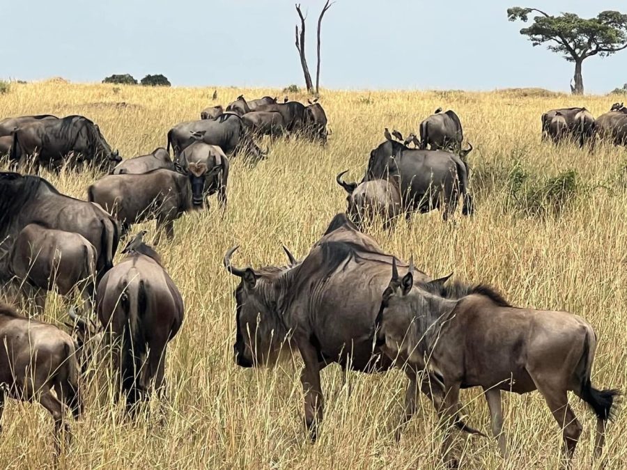
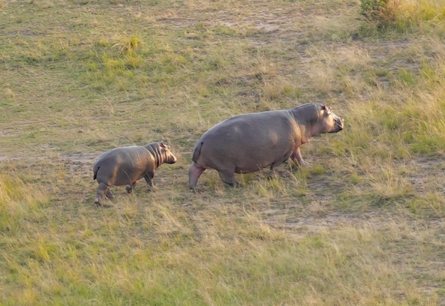
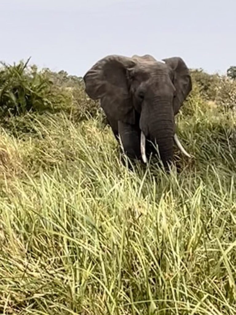
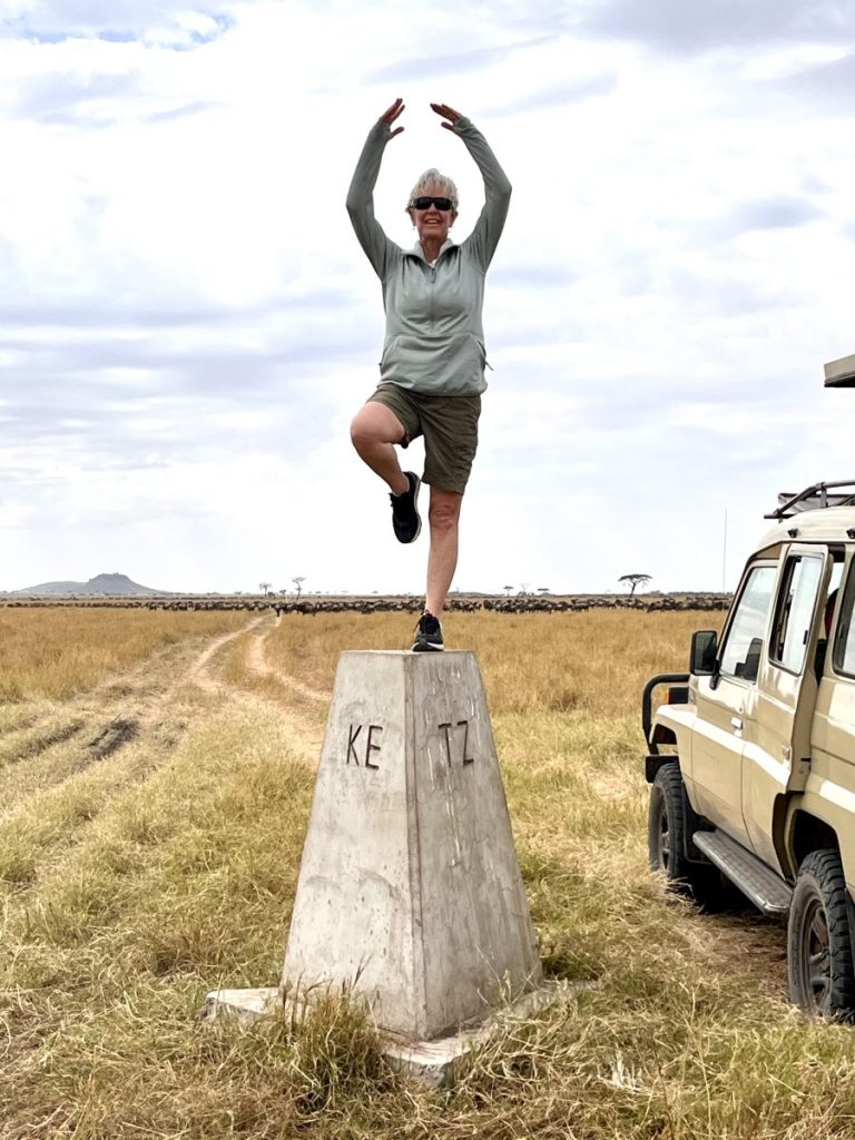
Today I will check-in with the group and tomorrow is orientation. I’m really glad I chose to come early to be able to adjust to the time change and recover from jet lag. Others in the group have had issues with flight delays and cancellations so I am glad I am here and am eager to get on the trail. I haven’t hiked in two weeks and can feel the difference in my well being. Two women from the group, Joanne Simmons and Kristen Gillan, joined me for the weekend visiting the northern part of the Serengeti National Park. We have had an awesome time and are now refreshed and ready to start climbing. It has been one of my lifelong dreams to see a big game park in Africa and feel blessed to have accomplished this while I still can. I have never been one to delay achieving my goals but with PD I feel even more determined to get out there and live life fully. I am looking forward to meeting the other team members and getting to know their stories. Then there will be the final packing of my gear. I think I have overpacked and will need to shed some of my things. Now to figure out just what has to go and what can stay behind to be protected for the 8-day trek.
I am frustrated with the slow wifi here and am struggling to post on this blog site. I will undoubtedly revise my entries but at least for now readers will have some information about what is happening on my grand adventure.
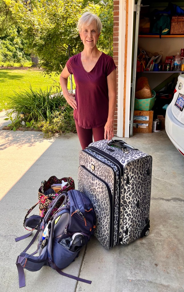
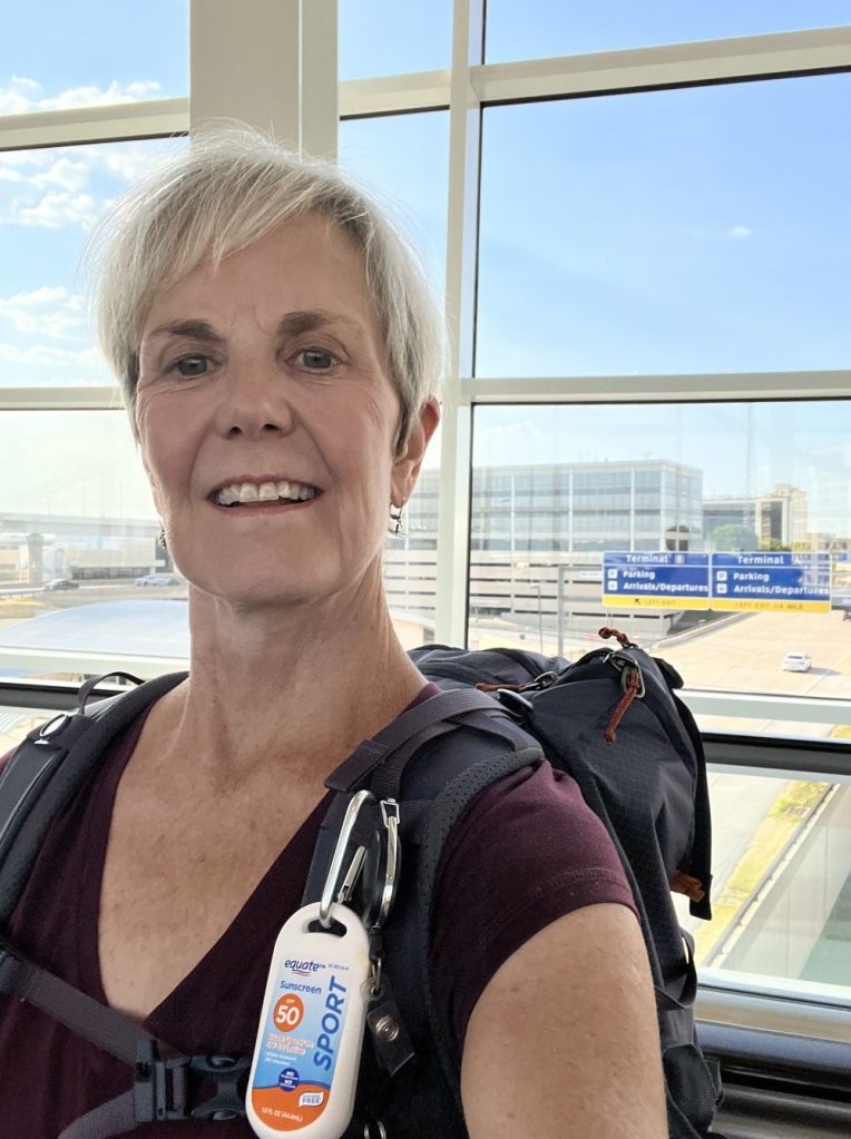
The day before I was to fly out of Asheville was a busy and hectic day. There were lots of things I needed to do before I left my home for 18 days. I had bills to pay, emails to respond to, garden produce to manage, cleaning to do, calls to make, and last minute packing to accomplish. I felt some pressure and anxiety as I readied for the trip. My husband would describe me as somewhat irritable and that I was. On the way to the airport, we had lunch at one of our favorite restaurants in Biltmore Park to celebrate our anniversary as we hadn’t taken time to do that yet. We finished the meal with fresh strawberry shortcake and ice cream. Then we were off to the airport to check in, clear security and wait to board. Since you can’t linger long at the airport curb, we said a quick goodbye accompanied by a short kiss and I proceeded to the check in counter. The line was short so I breezed through to the waiting area at my gate with plenty of time to sit and wait. Ugh! I wish I hadn’t beein such a hurry to get there.
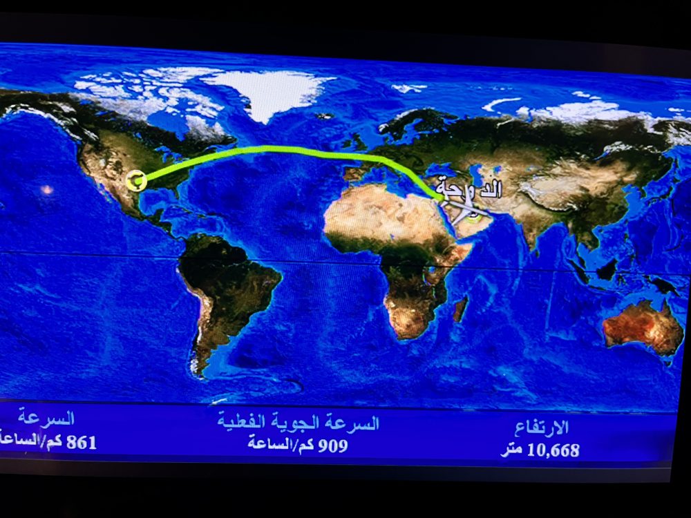
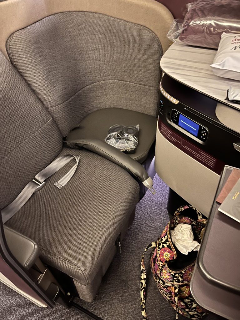
The flight to Dallas was just under three hours but was a bit rough from turbulence. It felt good to disembark and with about four hours til the next leg I used my time to have a nice Mexican dinner. Then I found my next gate and relaxed for a while. But with time on my hands and mountains to climb, I found a long staircase to ascend and descend at least three times, carrying my heavy carry-on bags. At last it was time to board my next plane. The line was very long and my coach seat was near the rear of the plane. I began nesting in my little zone by the window that I would be occupying for the next 14-15 hours. I had my shoes off, neck pillow out, ear phones ready, and was exploring the little amenities bag when a flight attendant stopped at my row of seats and asked if I was Lucreeta Moooore Pin Pin ta to which I said yes. He asked to see my boarding pass and passport. Oh no!! Was I being deplaned?! He explained that I was being reassigned to business class and to please get up and relocate. The thought went through my head that many were praying for me but I wondered why God favored me over the older-than-me woman wearing a neck brace and who’s jaw dropped with envy as I left her row. I thought about offering her the exchange for just about 2 seconds before proceeding to my new nest. The upgrade was magnificent!! There was a lot of room with a seat that positioned flat so that I could sleep fully horizontal, pajamas, amenity box with lotions, plush pillow and blanket and almost full privacy with a door that closed across the entry to the cubicle. I changed into the pajama shirt and had to smile as the outfit made me look ready to report for duty on the starship Enterprise. I had my own personal flight attendant who offered me just about anything I could ask for. But all I really wanted was to stretch out and sleep. About 7 hours later I woke up in a time warp. I had no idea how long we had yet to fly, what time it was or whether it was light or dark outside. I ordered breakfast consisting of fresh fruit, yogurt, granola, assorted breads, and strawberry smoothie. It was served on top of a cloth cover for the tray table and the elegance was completed by a little candle too. You can tell I only fly coach.
The next leg started by disembarking at the Doha, Qatar airport with a 10 hour layover. I had reserved a sleep cubicle hoping to get some sleep but the mattress was hard, the walls were thin, the pillow was uncomfortable, however, it did give me a private place to rest before the next leg. I got up at six o’clock and freshened up a bit. The attendant at the desk of the sleep-n-fly area told me the gate assignment for my next flight and I set off to find it. After walking a long way and taking a train, he was wrong. I had to go back from just about where I started, so I took off running to get there. Once at the gate, I linked up with Jo Simmons who is also on the climb and who had recently come to Asheville to hike with me. We boarded our plane without difficulty and had smooth sailing the rest of the way. There was a brief stop at Dar es Salaam and then on to Kilimanjaro airport. We landed on a strip that seemed to be a remote, dry area. There was no chance of a Kilimanjaro sighting as the sky was fully covered in clouds. The customs procedure was fairly easy and when done, our ride was waiting for us. I purchased a local sim card for my phone which took a lot of time to accomplish. Then we headed out for the hour drive to our lovely hotel where I am now fed, showered and ready to sleep. Enough of this tale for now.
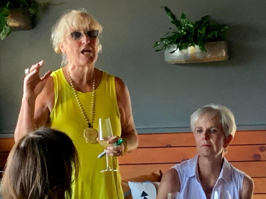
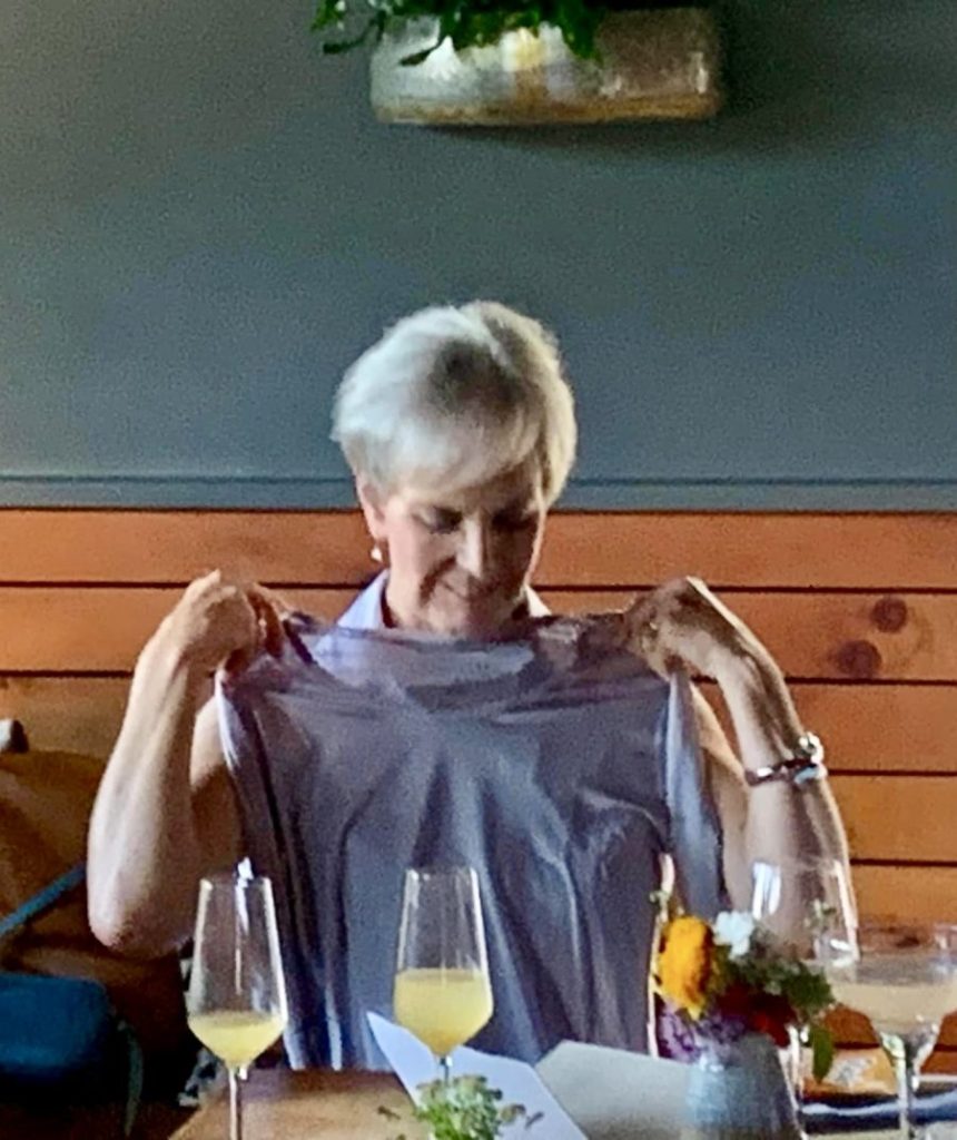
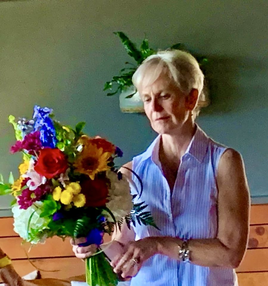
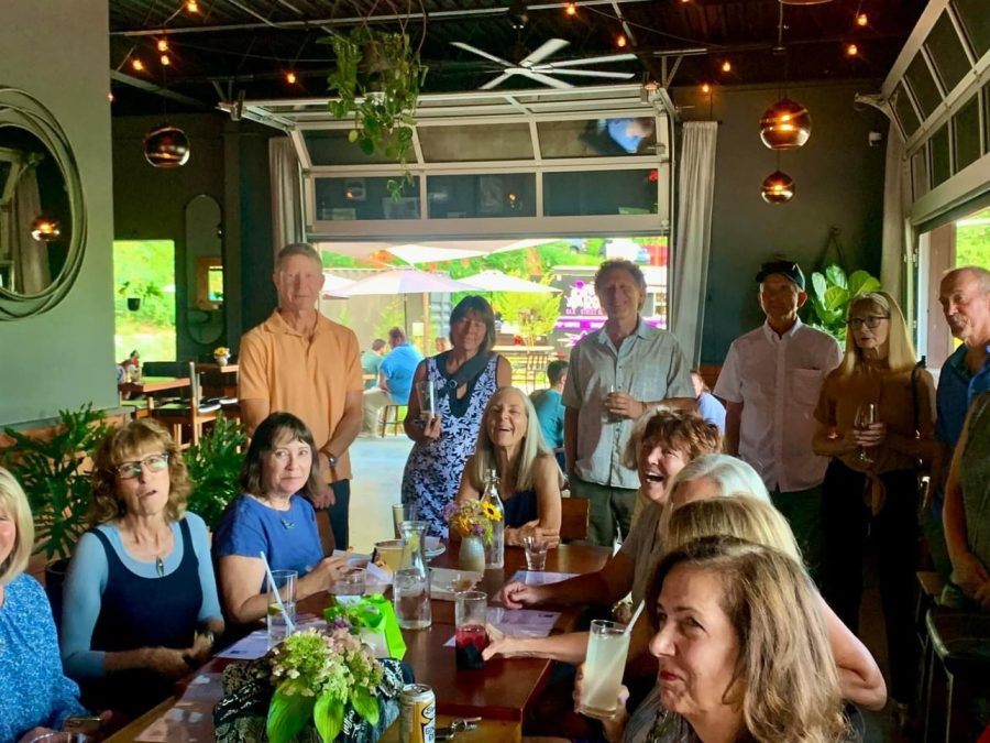
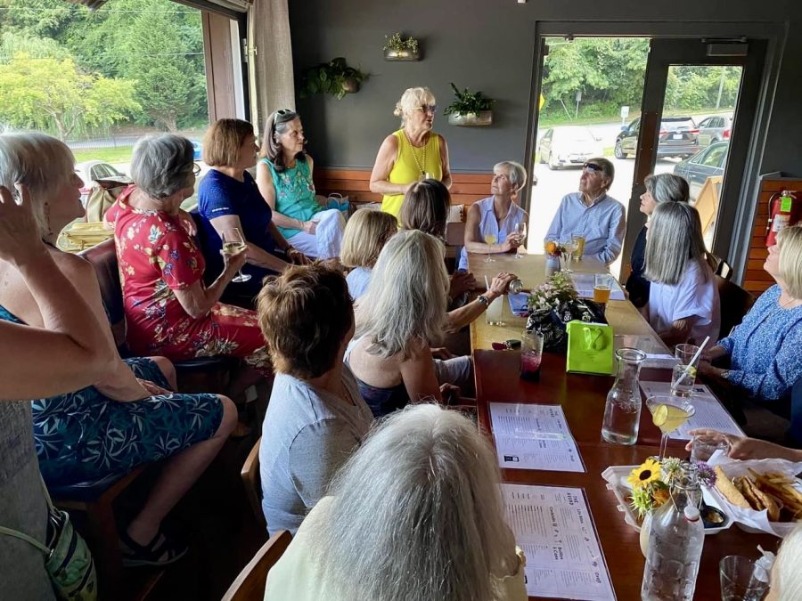
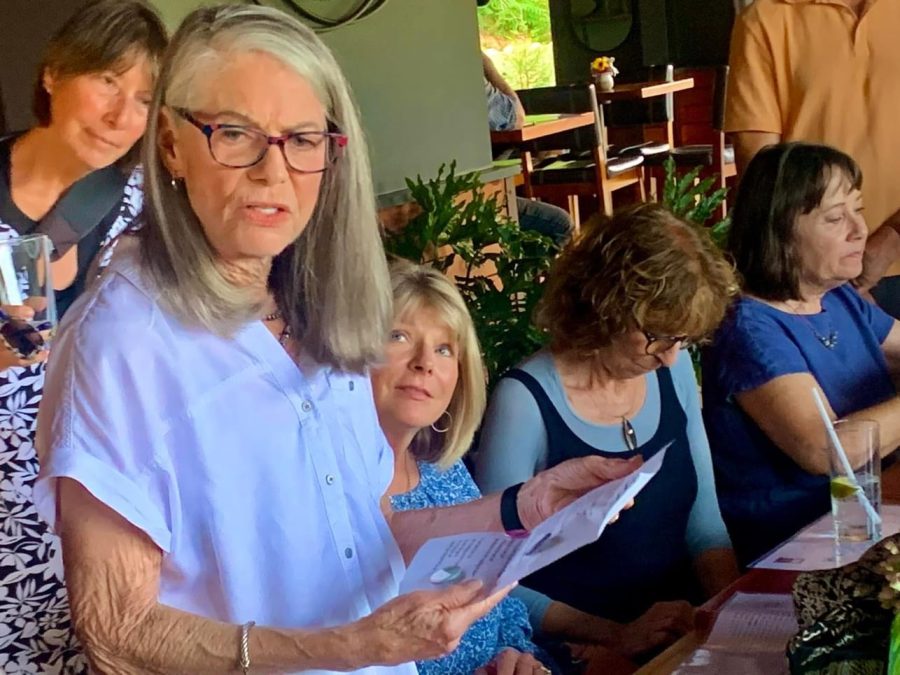
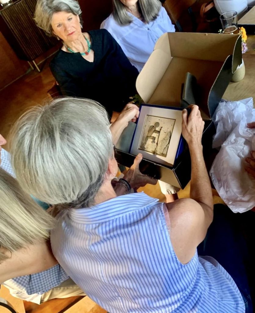
This will be my last entry before I fly out of Asheville on Tuesday, August 1. This week has been busy with getting many last-minute details taken care of. There were purchases to make, packing to be done, bills to be paid and many other things to attend to. By far, the highlight of my week was the Bon Voyage Party my hiking club gave me. I started my own hiking group when Covid had the country shut down. I knew I could not take a break from the outdoor activity that gave me so much help in dealing with PD. Other groups I had been hiking with decided to halt activity for the most part, but I felt this was unnecessary to stay safe. In fact, I felt that being active in the outdoors was a good way to preserve immunity and health. So, I offered invitations to hikers I knew and started Lucretia’s Hikers. By now, the group has grown to about 60 members with about two thirds of them regular hikers with me. The others hike infrequently or are “lurkers” as they enjoy the pictures of the group hikes I post to our site. Over the many miles and hours on the trails, I have gotten to know the members well and many have become very close friends. They have been a constant support in every aspect of my life. The party was overwhelming by the outpouring of support and affection shown to me. The attendance was large, and they gave me flowers, gifts for the trip, a banner to pin to my pack on the trek and a card signed by everyone. Individual members gave me personal cards, and one member wrote a limerick personalized for me. Another member created a picture from stones, moss and a stick that displays a hiker climbing a mountain. The box it came in was wrapped in a beautiful silk scarf with fresh flowers instead of a bow decorating it. I was rendered speechless and in tears by the overwhelming demonstration of love and support. To say thank you does not seem adaquate to express the gratitude I want to express to them for the many, many ways they have been there for me. But my hiking group members are not the only ones who have been very supportive both in my ambitions to climb Kilimanjaro but in the daily, continuous struggle of handling life with PD. I have a long list of friends, family, church members, neighbors, and even strangers who have offered both monetary contributions to my fundraising campaign as well as overwhelming love and support. This is not casual support but the kind where one will be available 24/7 to listen, or talk, or go places, or take care of physical needs. My well is brimming over with genuine friendship, concern, and love. I wonder how I got so lucky to have such a tremendous throng of advocates but am eternally grateful to the many, many people who have touched my life with their generous outpouring of kindness and devotion. The list is too long to name everyone I appreciate and want to thank but I would like to mention Lisa Scaterragia, my publicist, who has given many hours helping me get the word out there. Then, I would like to thank my family members comprised of my four brothers and their wives, my nieces and nephews and their spouses and children, my father’s wife, my husband’s family especially his children who I consider my own too, and their significant others and children, and my daughter Lauren. But the one who gets the most billing and who has stood by me through everything is my precious husband Jay of 32 years today. He is my rock, my best friend, and the love of my life. I love you with all my heart and will be running to your arms when I return.
Ana Boza the party organizerMe with Jaya warm silk shirt for the tripJulie, Nancy and ChristineKristi reading her limerickHandcrafted picture from Debi
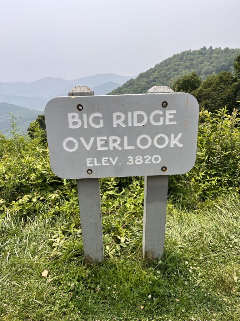
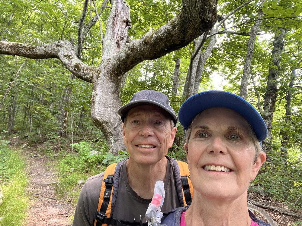
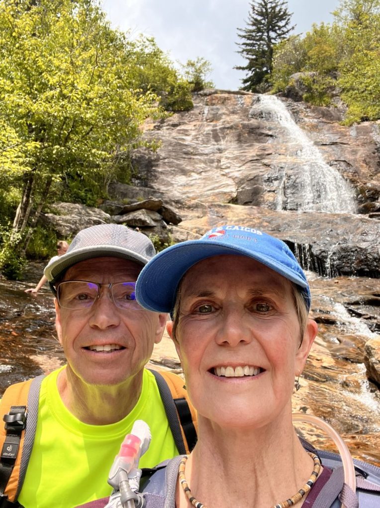
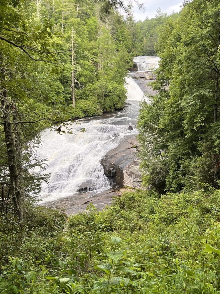
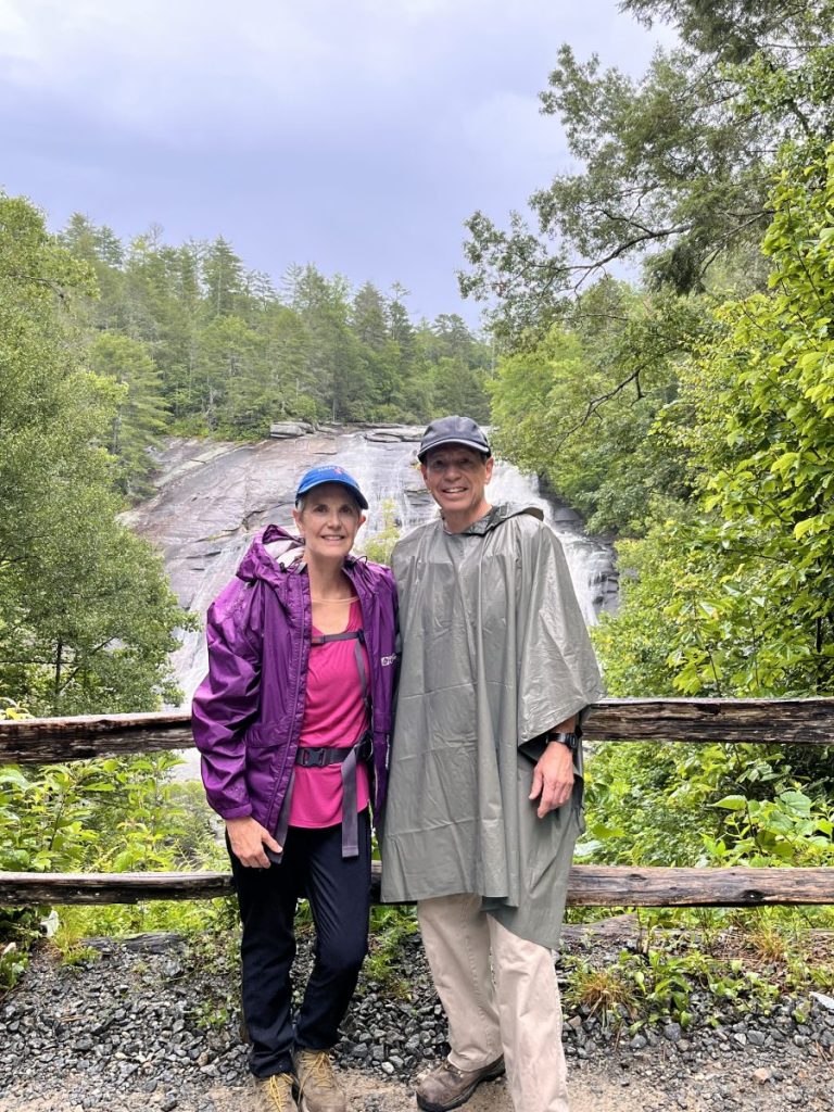
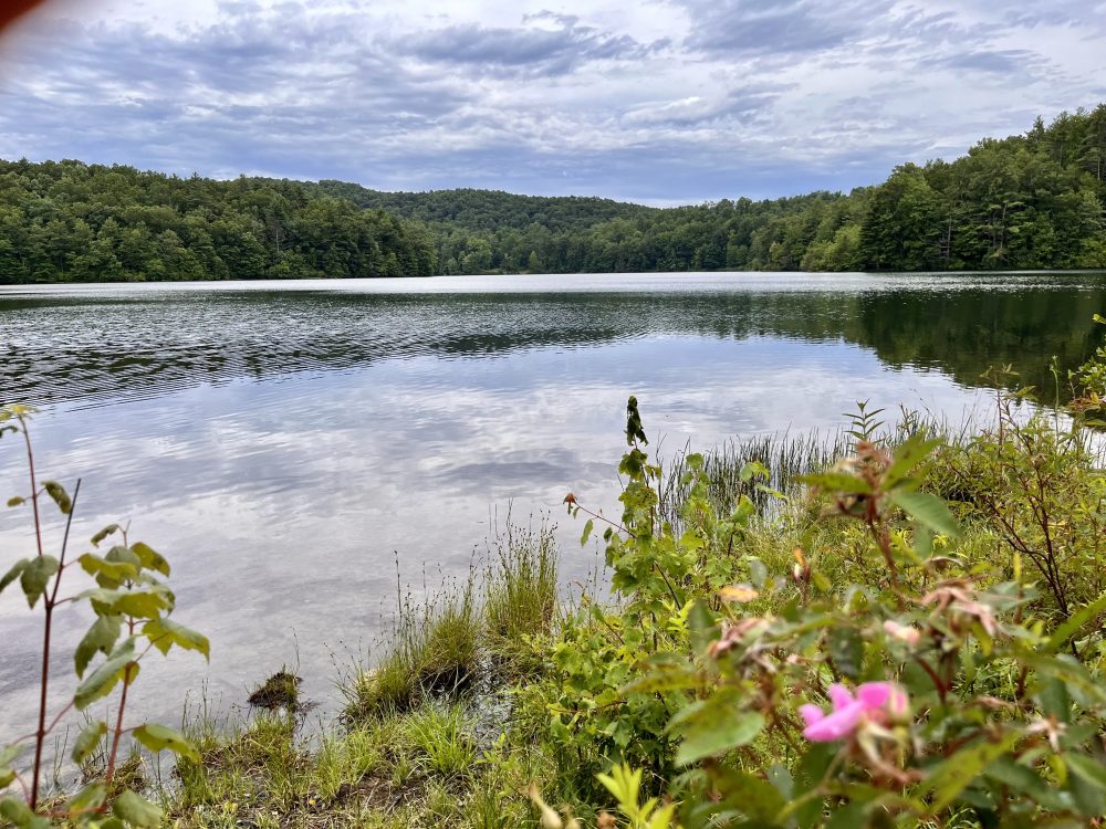
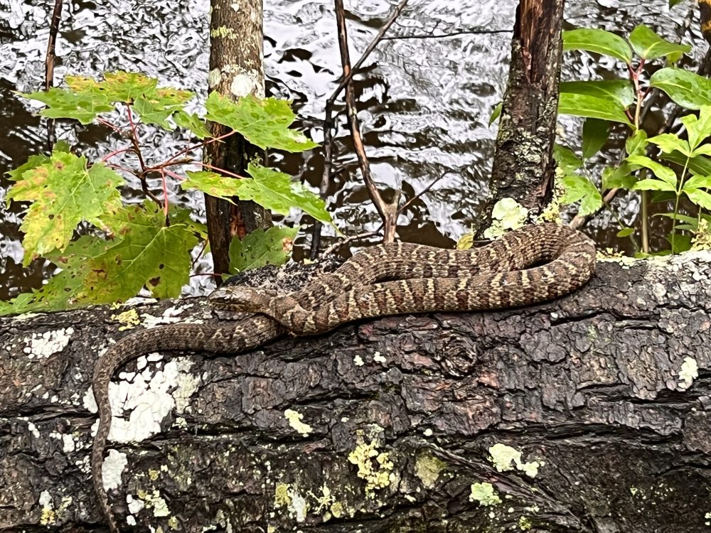
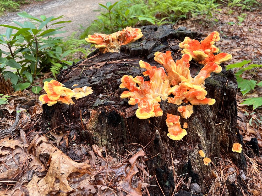
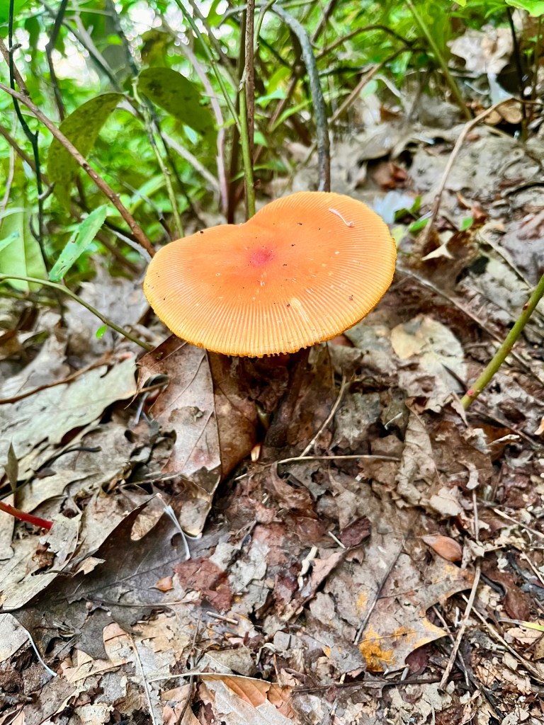
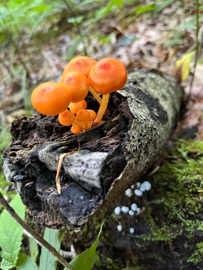
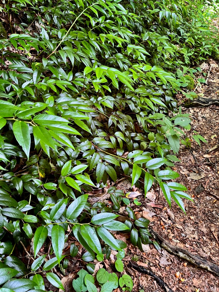
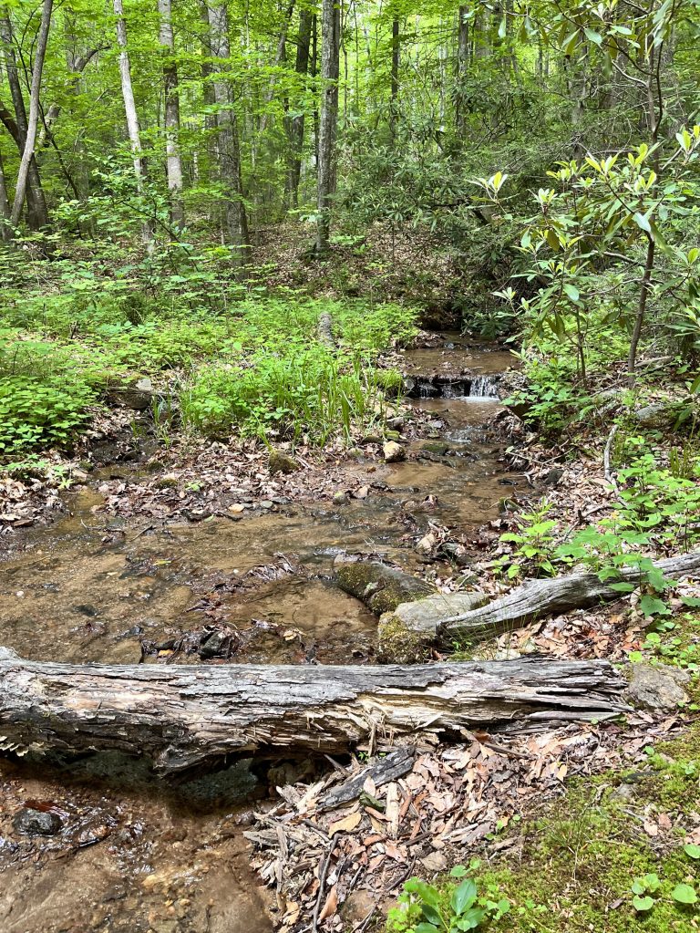
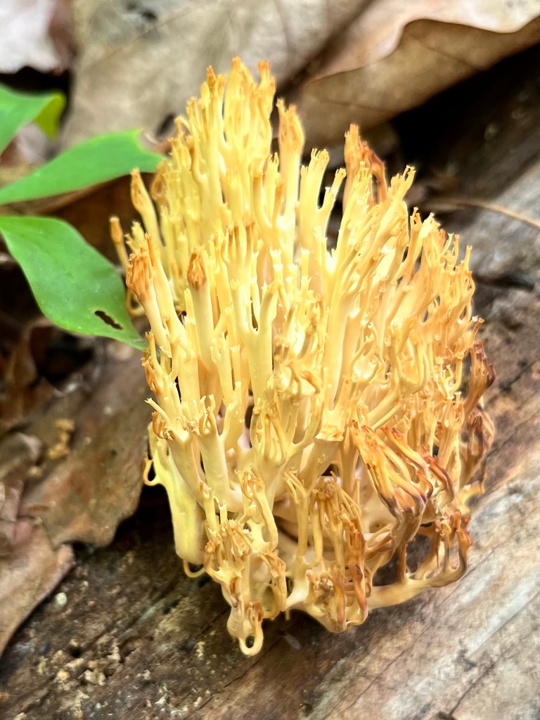
This past week I hiked six of seven days. My brother Bob came down from Michigan to hike the first three days with me. Then we had a day of drenching rain that nourished our dry area and Bob left to go back to Michigan, so that gave me a day off. Then, Joanne Simmons, one of the Michael J Fox Climb Kilimanjaro team members, flew in from New Jersey to spend three days hiking with me. Bob and I did three very different hikes. The first was a short 5.5-mile hike along a section of the Mountain to Sea trail from Big Ridge Overlook off the Blue Ridge Parkway to Shell Knob. On the second hike we invited members of my hiking group to join us for a trek from Skinny Dip Falls to Upper Falls at Graveyard Fields. This 8.6-mile and 1,400 ft elevation gain hike was a challenge but very pretty. We enjoyed four waterfalls, a mountain river, interesting fungi, flowers, and diversity of trail construction. Half of the group did a shuttle and returned from Graveyard Fields while the rest of us returned on the same trail back to our car. The third hike was to see the grand falls at DuPont State Forest. It started out to be a drizzly day, so we donned rain gear and headed out. We took in Hooker Falls, Triple Falls, High Falls and three lakes for an 8.5-mile hike with a surprising 950 ft. elevation gain. In addition to the usual trail sights, we spotted a quiet, unobtrusive, peacefully resting water snake and a gorgeous cluster of what I think is Chicken of the Woods, a brightly colored fungi that can be eaten if you’re sure of its identity.
Bob and me first day Crossing the river at Skinny Dip FallsRhododendrons along the pathUpper Graaveyard Fields pathUpper Graveyard Fields FallsTriple Falls at DuPontHigh Falls at DuPontIn the rain at DuPont State ForestLake JuliaChicken of the Woods
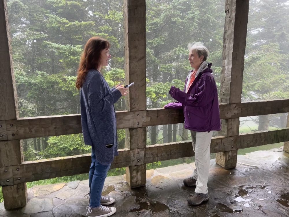
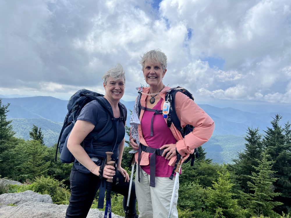
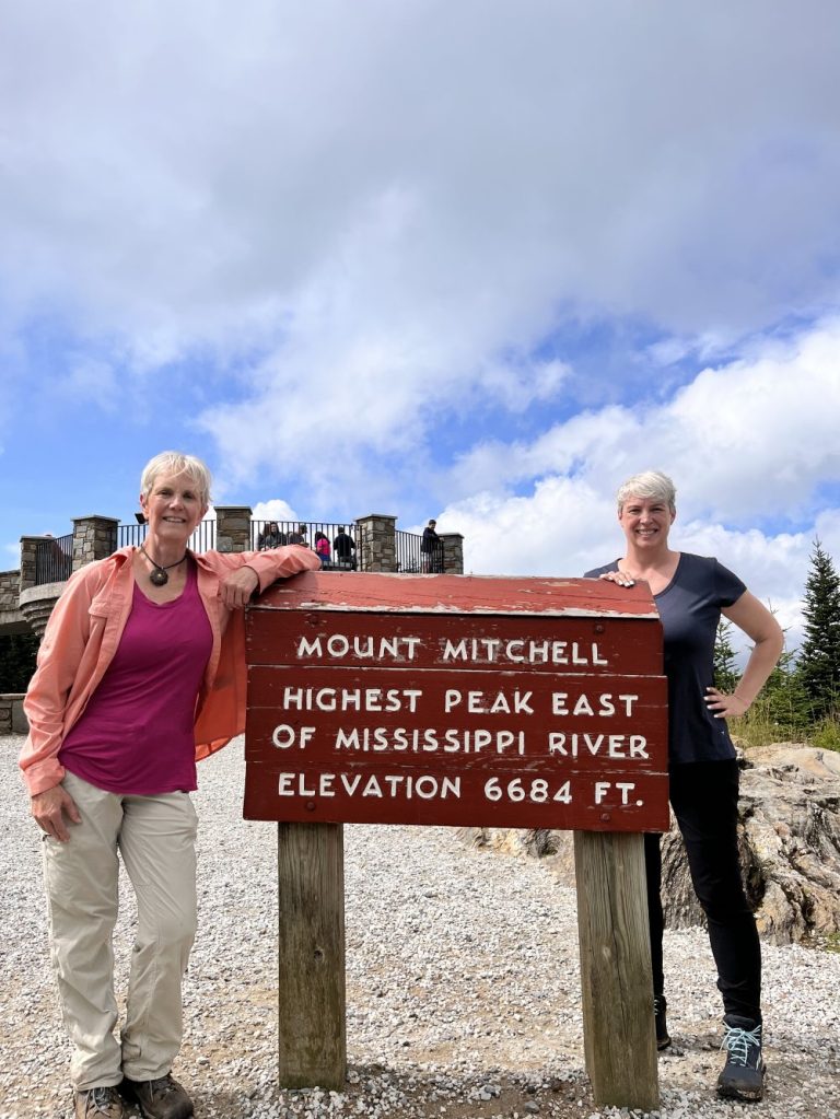
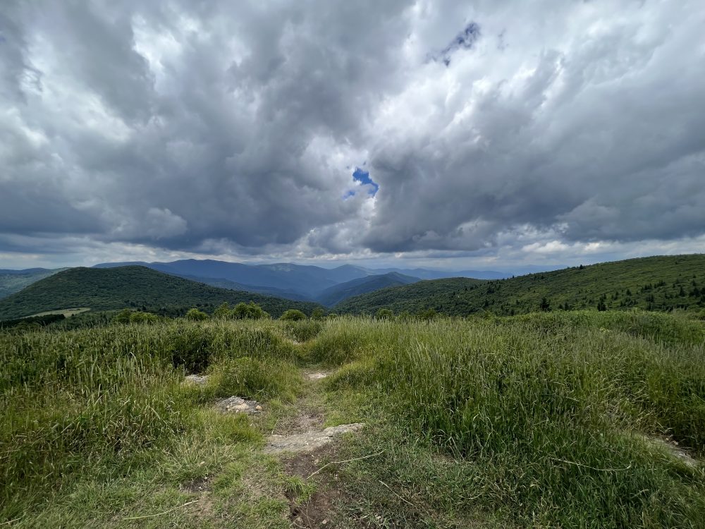
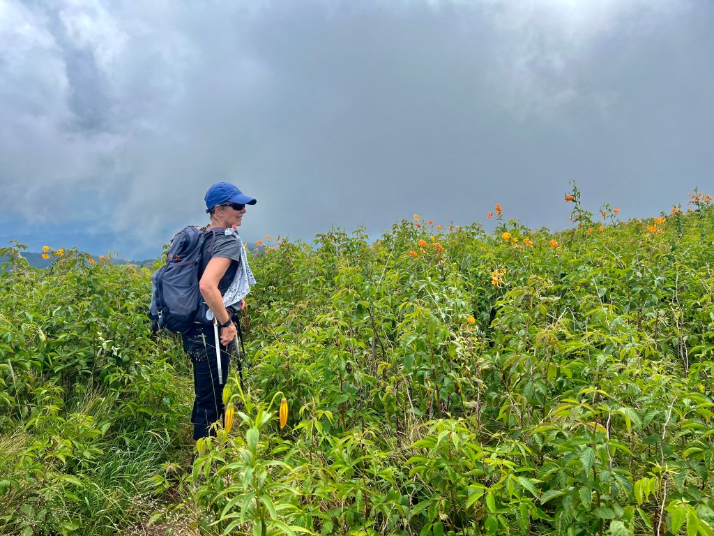
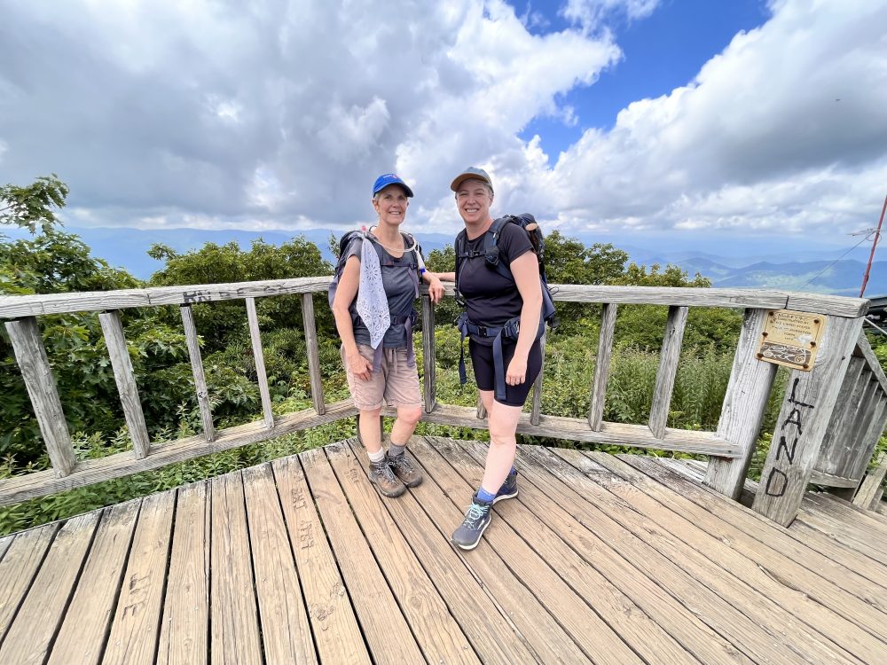
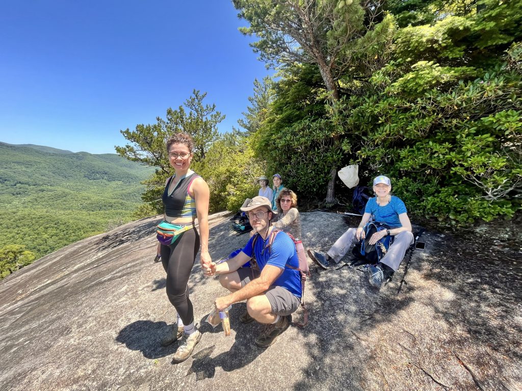
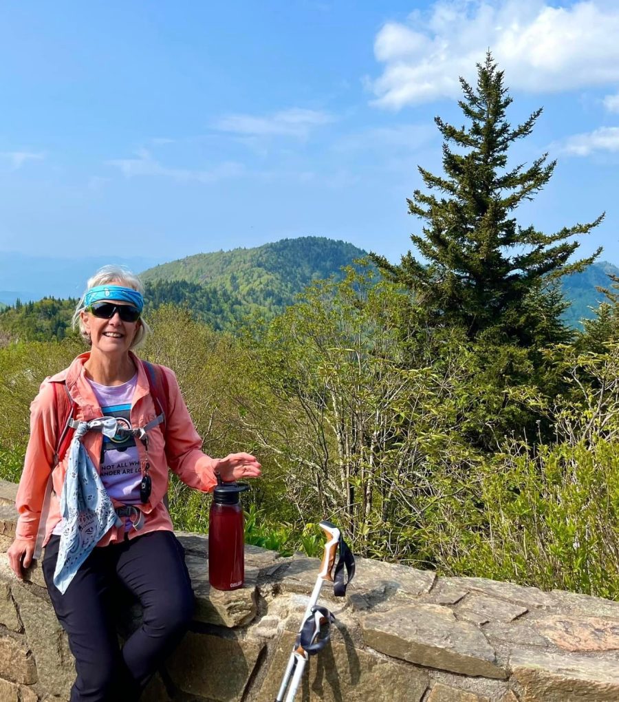
Joanne aka Jo, and I did three days of different hikes as well. The first day we went to Mt. Mitchell, the highest point east of the Rockies. As we drove up the parkway to the Mt. Mitchell area, we entered very dense fog, the kind you can barely see a car length ahead. It was windy and cold and of course views would be non-existent. Once at the trailhead, we were greeted by a reporter and a photographer from the Asheville Citizen Times, our local newspaper wanting to do an article about my planned adventure. I was interviewed and photographed for about 45 minutes and then we were off in the cold, windy, damp, and foggy weather to see how far we’d be able to go. The weather improved as we trudged on, but the tail was very slippery as we got our footing on rocks and roots. Then there were technically difficult places requiring the use of our hands and ropes to scramble up steep, rocky, muddy, and root laden patches. Eventually, we came to Big Tom and then Mt. Craig which had glorious views from their higher than 6,000 ft. elevation points. We finished our hike at the Mt. Mitchell peak and observation point and were grateful the sun was partially out giving us the beautiful views we were hoping to see. The second day with Jo, we went to Black Balsam and Mt. Tennet to hike. This was completely different from Mt. Mitchell in that most of the trail was exposed to the sun and the paths were more like trenches than flat trails. We were glad we applied sunscreen as it was a sunny day with lots of exposure. On top of Mt. Tennet, we had sweeping panoramic views and found other hikers who were interested in chatting about our training for the Kilimanjaro hike. The third day, I took Jo to hike Mt. Pisgah which isn’t far from my house. The short trail to the top was steep and we had to stop and get our breath a few times on the way to the peak. Once at the summit, we gazed at the very tall broadcast tower which can be seen from every direction in the Asehville area. After we got back to our car, we decided to take the short drive to hike to and climb one of the few standing fire look-out towers in the Blue Ridge Mountains. The walk from the pullout off the Blue Ridge Parkway was a steep, gravel road about three quarters of a mile mostly in the sun. The tower had a very steep, metal stairway to climb that was not for anyone who might be afraid of heights. We chose to go on up the ladder and take a look at the views which did not disappoint. The mountain ridges stretched out before us in every direction with their slightly blue hues characteristic of the mountains of Western North Carolina. Then it was back home, shower, grab a bite to eat and off to the airport for Jo to catch her flight back to Jersey City. We had a wonderful time over the three days we spent conditioning together and getting to know each other. I already know I have a friend for life and the bonds of this journey will be lasting. And that’s even before the hike where I will have other team members to get to know and share this trek of a lifetime. Looking forward to what lies ahead with less trepidation now. Thanks Jo for being a part of my conditioning efforts. Now to take a break from hiking for a few days as I must admit – I’m tired!
Starting out in the fogAt the top of Big TomTrek to Mt. TennetTop of Mt. TennettLooking at the Turks Cap LiliesTrail to Mt. PisgahTop of Mt. PisgahJo descending the fire tower
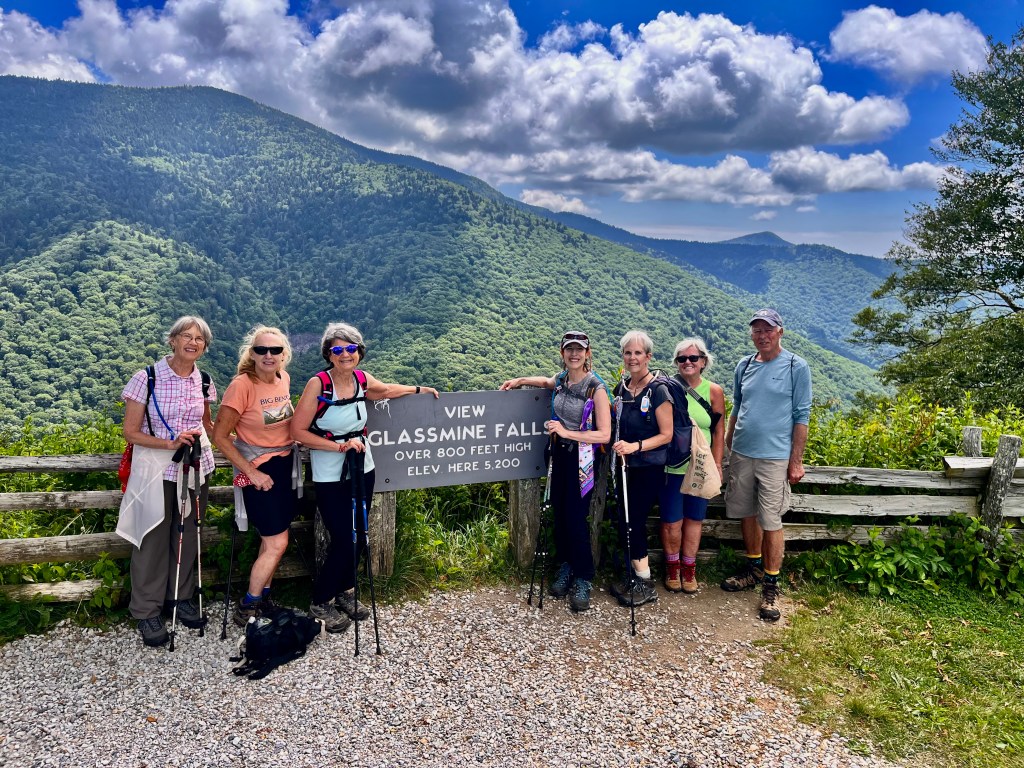
I got in two hikes this past week. One was from the Greybeard Overlook off the Blue Ridge Parkway to the Glassmine Falls Overlook. The other one was a trail that follows the Big East Fork River starting at a lower place than the part of the same river I did last week. As I hiked along these trails, I was in a reflective mood. My very dear friend Margie was near the end of her life and did indeed pass away before the second hike of the week. She was ninety years old and had waged a valiant war against cancer that invaded her body more than 20 years ago. I spent a lot of time with her after her husband Harold passed away a few years ago and we became very close. Margie was very inspirational to me in the way she lived her life. She persevered to live vibrantly and fully up to the end. She was my greatest cheerleader in my quest to summit Kilimanjaro and so wanted to see me make it to the top. As I traversed across the trails I noted that each path has its own unique personality and offerings. While all the trails I have been hiking on are in the mountains of Western North Carolina each one is different with varying flowers, trees, views, streams, waterfalls, and path configuration. The hike on the same trail can be quite different depending on the time of day and time of year. In the spring life is emerging with the fresh greenery on the vegetation and an abundance of flowers popping out of the ground. Summer is dense with the leafed-out foliage, bright with colorful flowers, hot with the humidity and sun, and the waterfalls are refreshing. Fall brings the vibrant red, orange, and golden tones of the leaves that sometimes seem to rain from the sky and then dance on top of the water as it meanders down streams and rivers. Winter is often cold and frosty and sometimes we have snow to navigate through. But with the leaves gone and the crisp atmosphere the cooler weather brings, the views are at their best and one can see much more clearly. I was reflecting how the trails I travel upon during the different seasons of the year are a metaphor for life itself. I find myself hovering between fall and winter now and wonder what lies ahead and what I will be able to see as I get into the winter of my life. But like my friend Margie, I do not plan to go softly into winter but rather meet it full on and find the rewards that remain to be discovered.
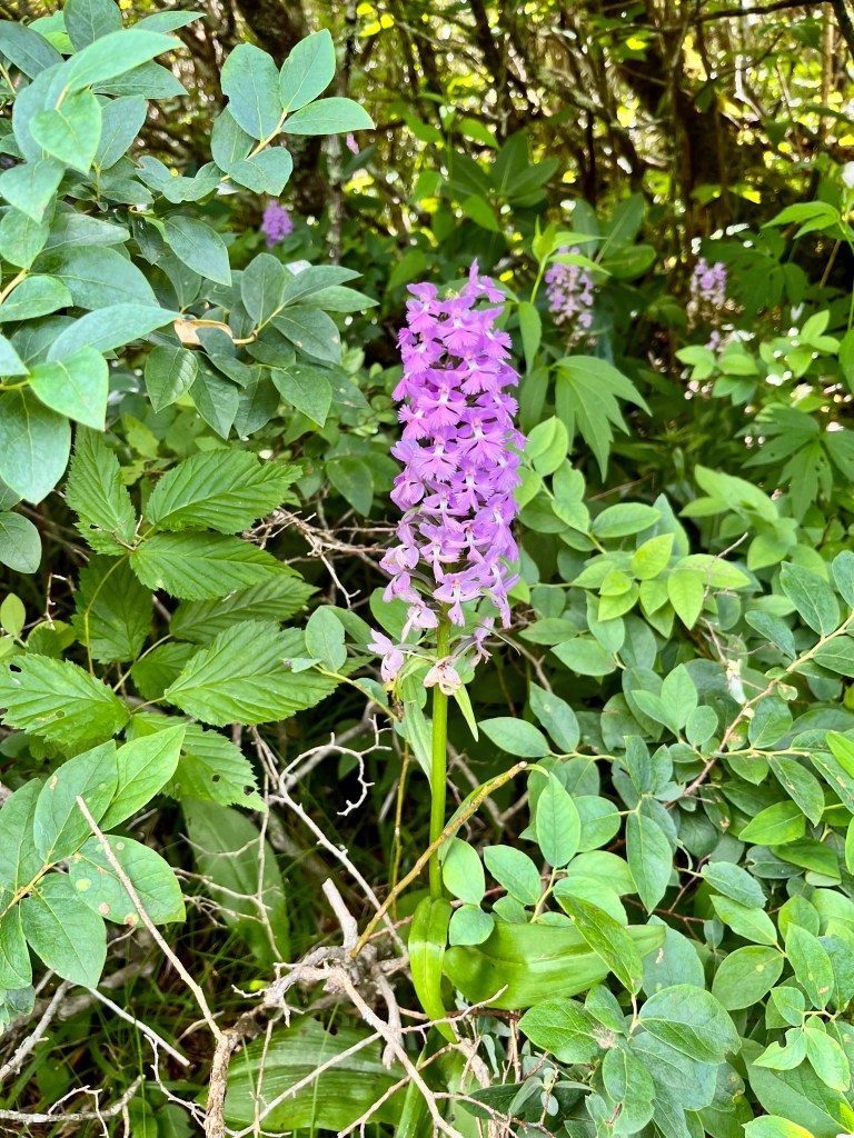
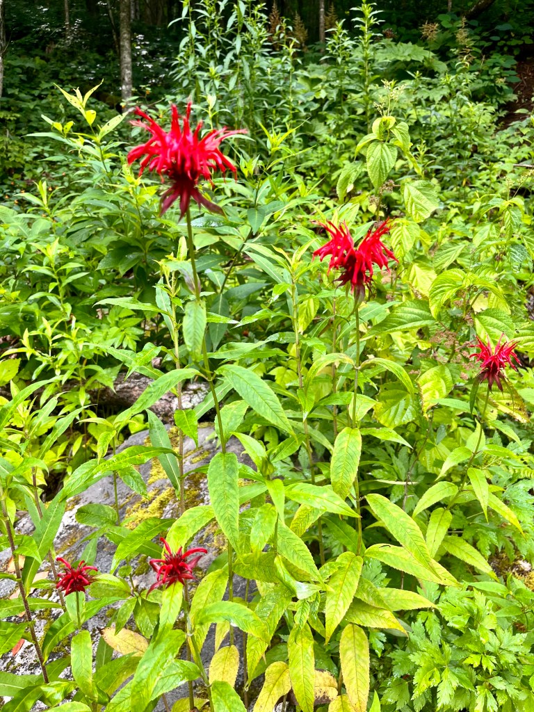
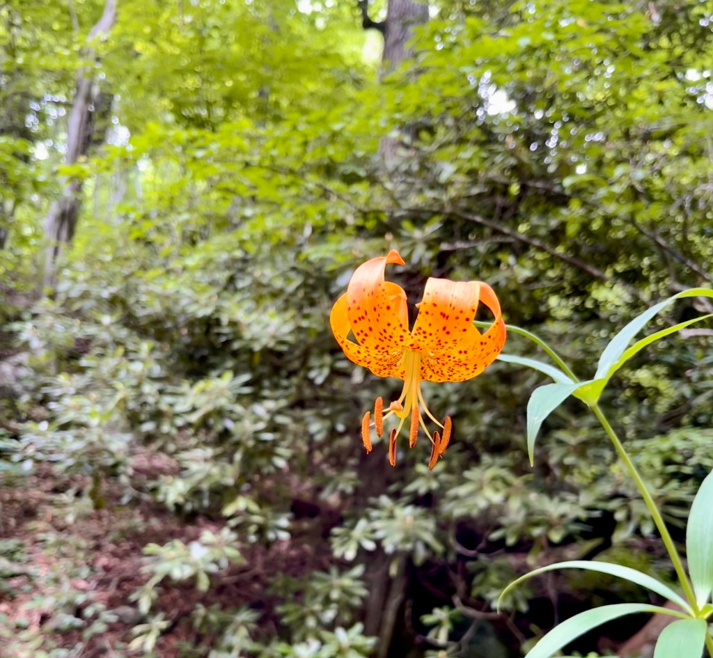
Pruple Fringed OrchidView from Locust KnobAmy, Vicki, Pam, Susan, me Wendy, MikeTurks Cap LilyBig East Fork RiverTrail on the side of the bankBee BalmKristi, me, Kim, Pam
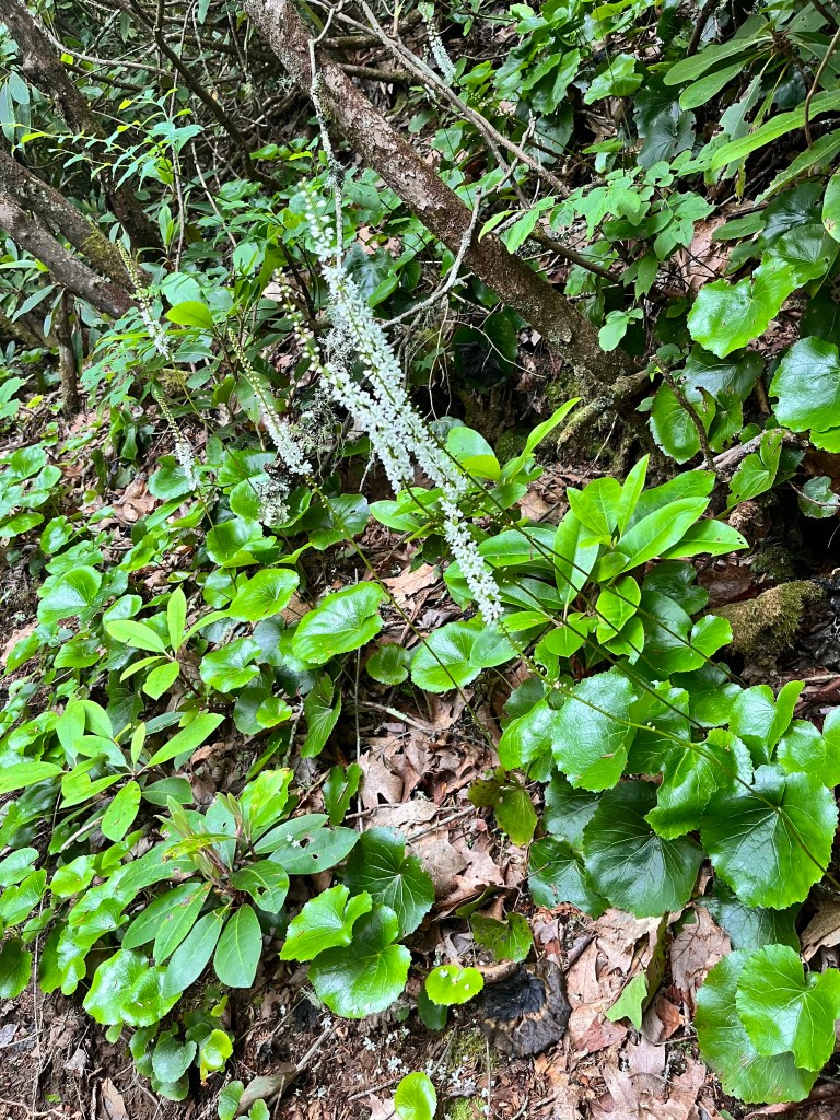
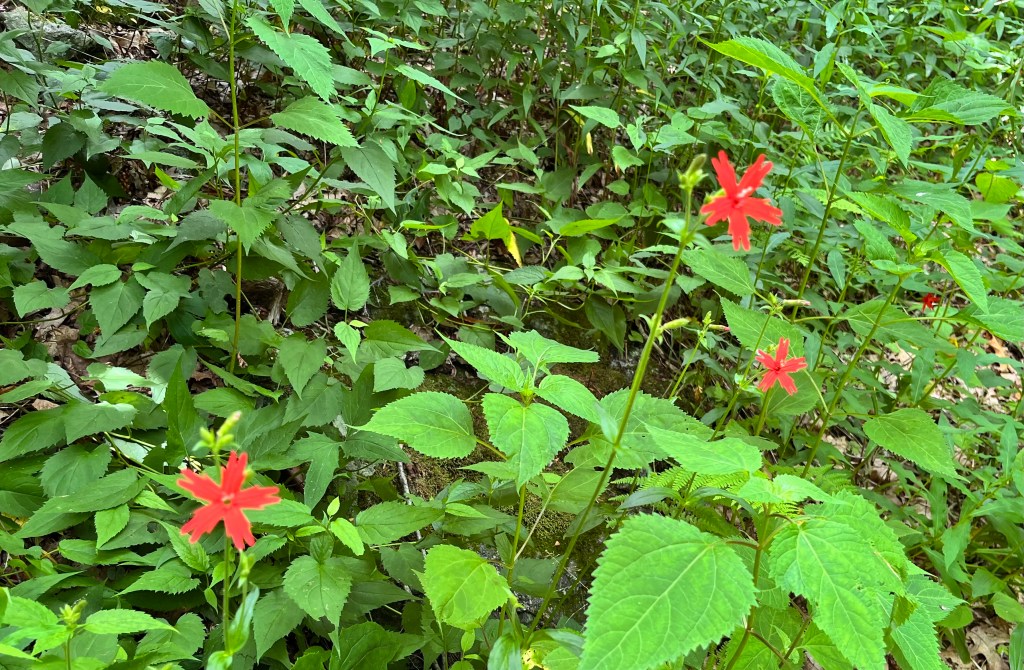
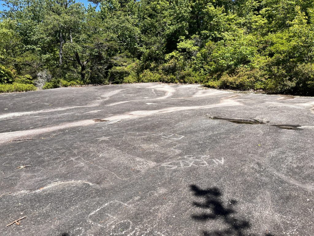
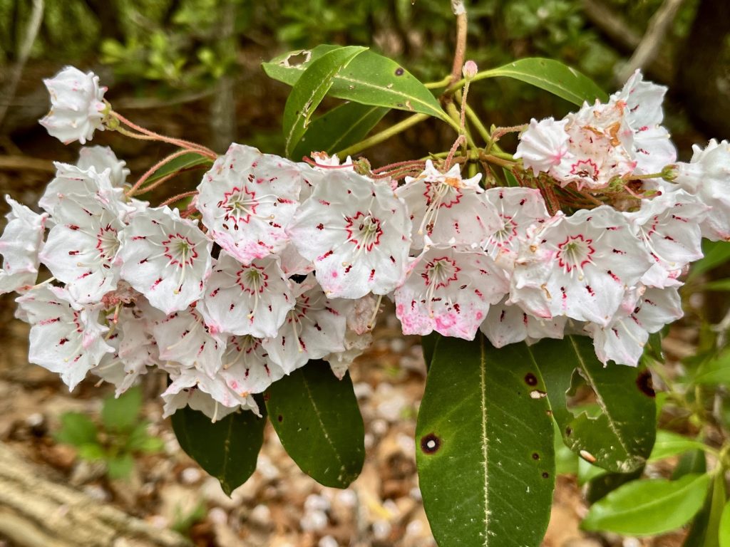
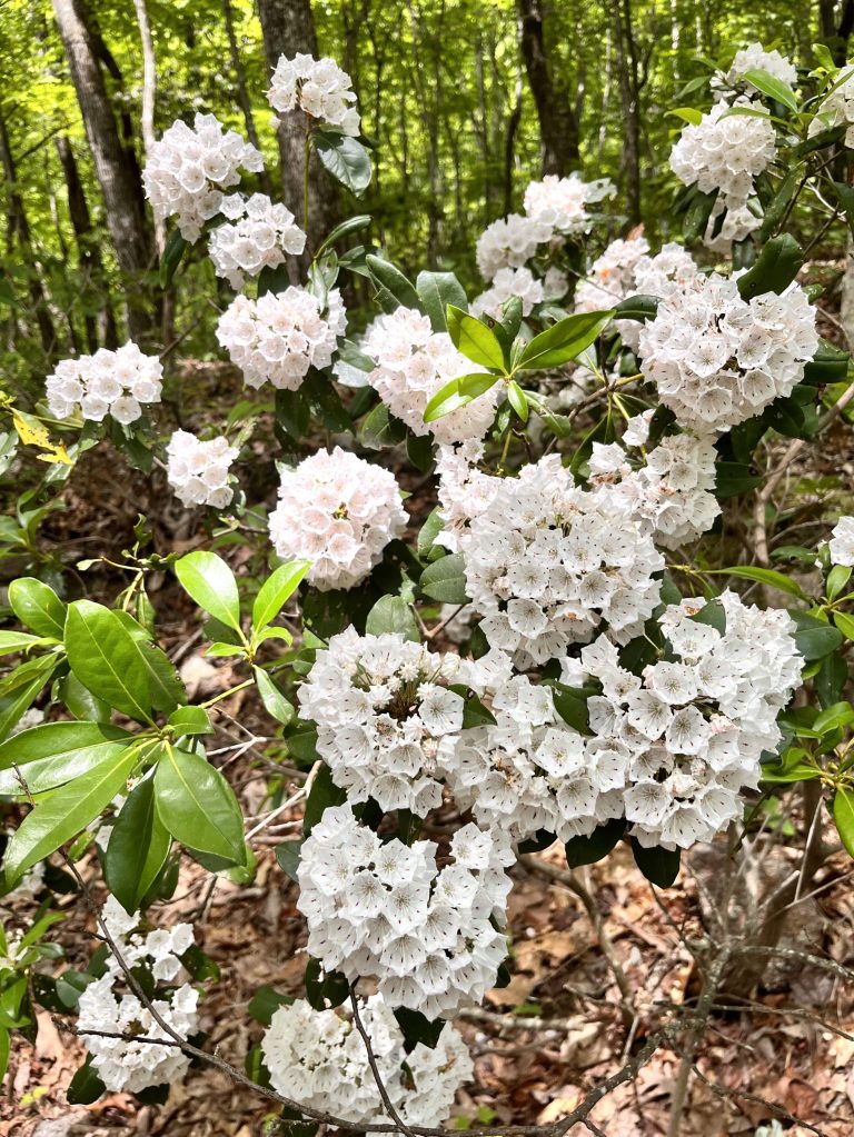
The first hike this week was a 9.25-mile, and 2,287 ft. elevation gain loop starting from the trailhead parking area for the Mt. Pisgah trail. Mt. Pisgah is an iconic peak about 15 miles southwest of Asheville, NC. It has the highest broadcasting tower east of the Mississippi River from its summit at 5,721 ft. The television antenna rises to 6,023 ft. above mean sea level and can be seen from all directions for many miles away. Our trek started on the Buck Spring trail passing the foundation stone for the historic hunting lodge of George Vanderbilt of the Biltmore Estate. From there, we took the Laurel Mountain Trail and wound around to Pilot Rock which is a bold-faced stone cliff providing views of the valley below. From there we kept descending down a steep, rocky trail and ended up on a gravel road. It was a long descent, so we knew it was going to be a hard climb up to our starting point. We found the Thompson Creek Trail and followed beside the pleasant sounds and sights of this mountain stream for about 2 miles. Along the way we spotted a Carolina lily standing all by itself. This variety of lily is the North Carolina state wildflower and is rather rare to find. We eventually got above the creek and the babbling sounds faded in the breeze as we continued trudging upward. We were pleased to find many plants in bloom including the Carolina Rhododendron, Mountain Laurel, Fly poison, Galax, Fire Pink, and even some late blooming native azaleas. After many zigzags we finally passed Little Bald Mountain at 5,286 ft. and from there it was all downhill back to our car. We made the journey in 5 hours and 7 minutes of moving time. I was grateful for the two women hikers who joined me on this delightful though tiring adventure.
View from hunting lodge siteMy hiking pals Debbie and SusanView from Pilot RockGalaxYellow leaves among the bright green foliageCarolina LilyFire Pinks
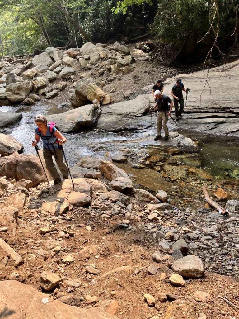
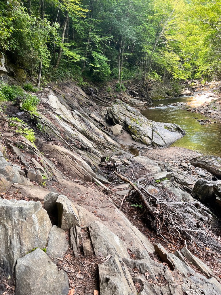
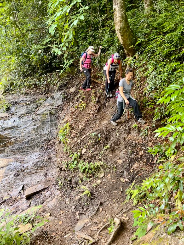
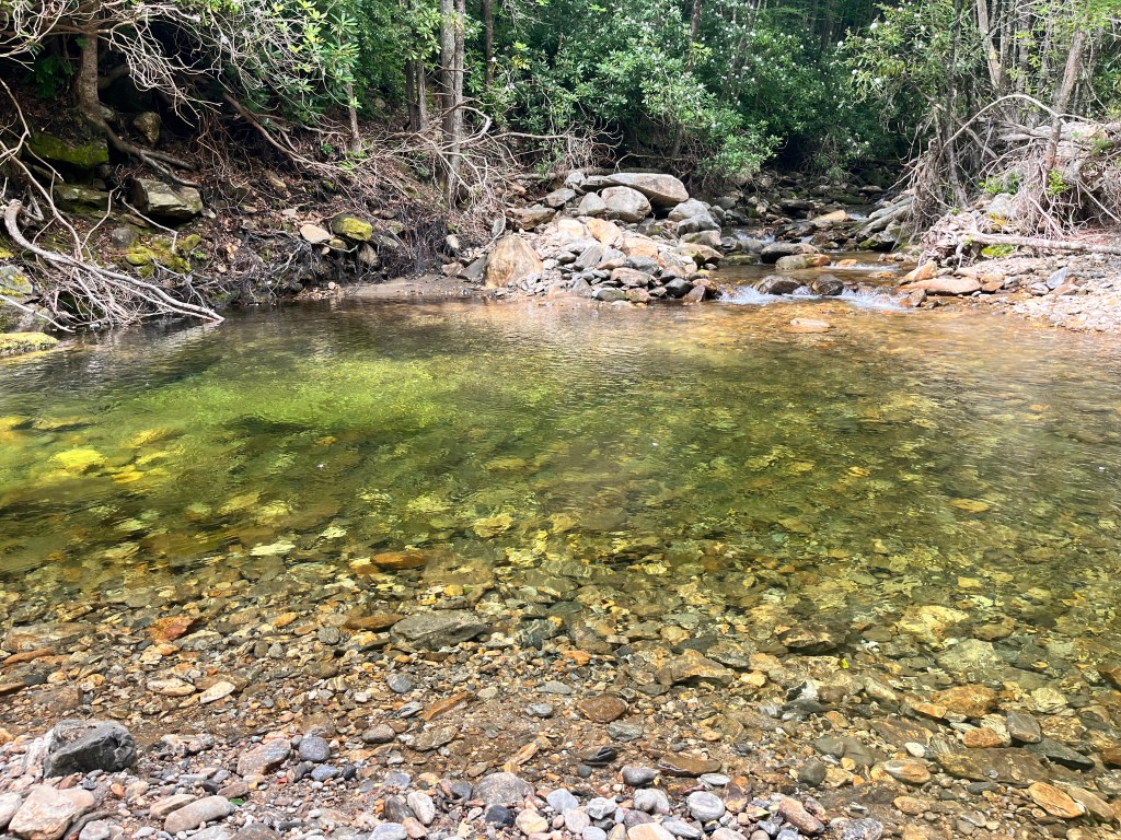
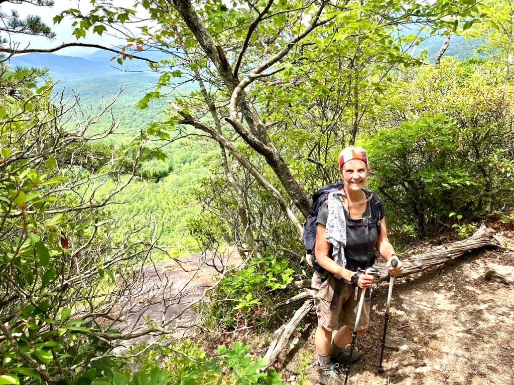
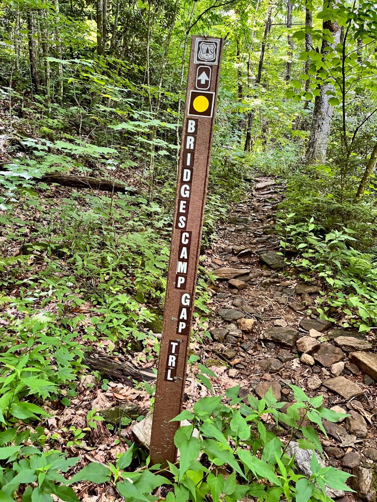
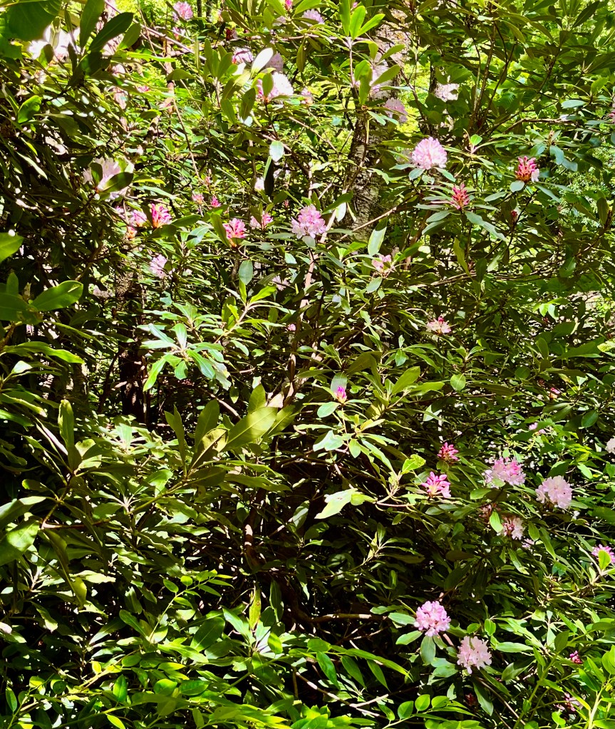
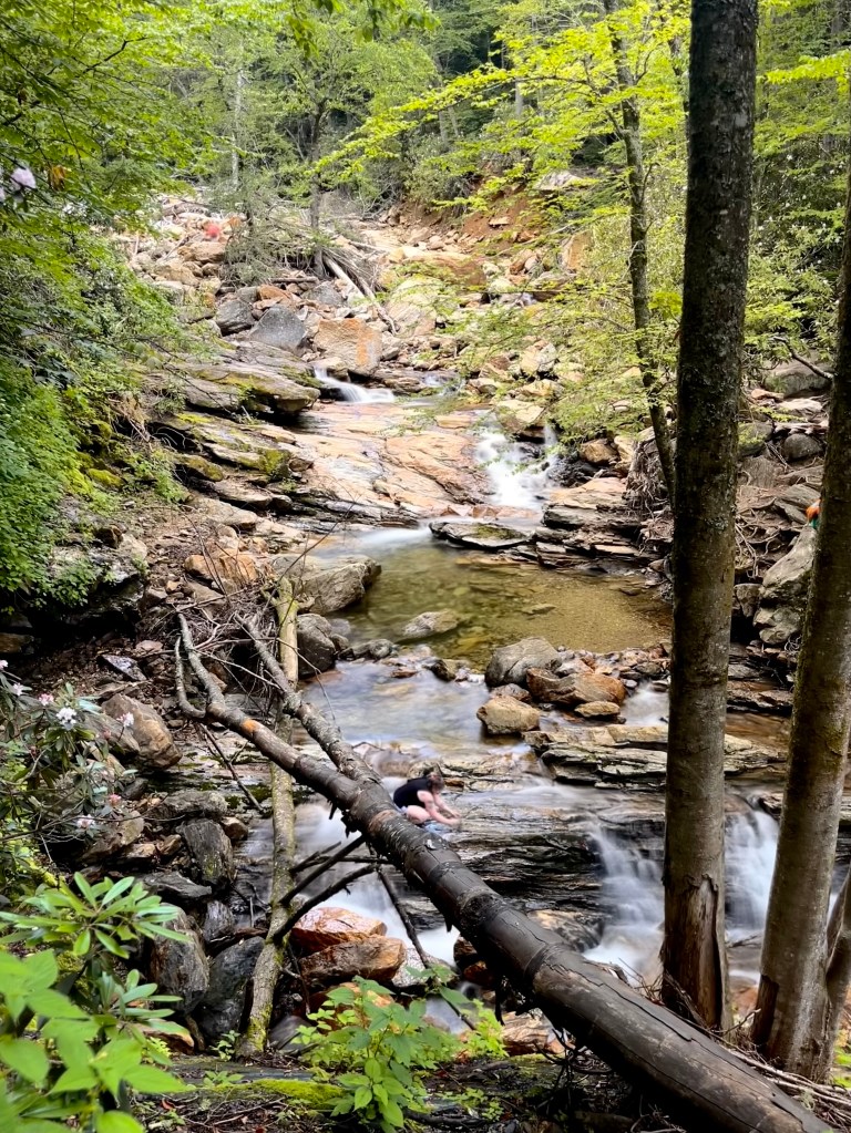
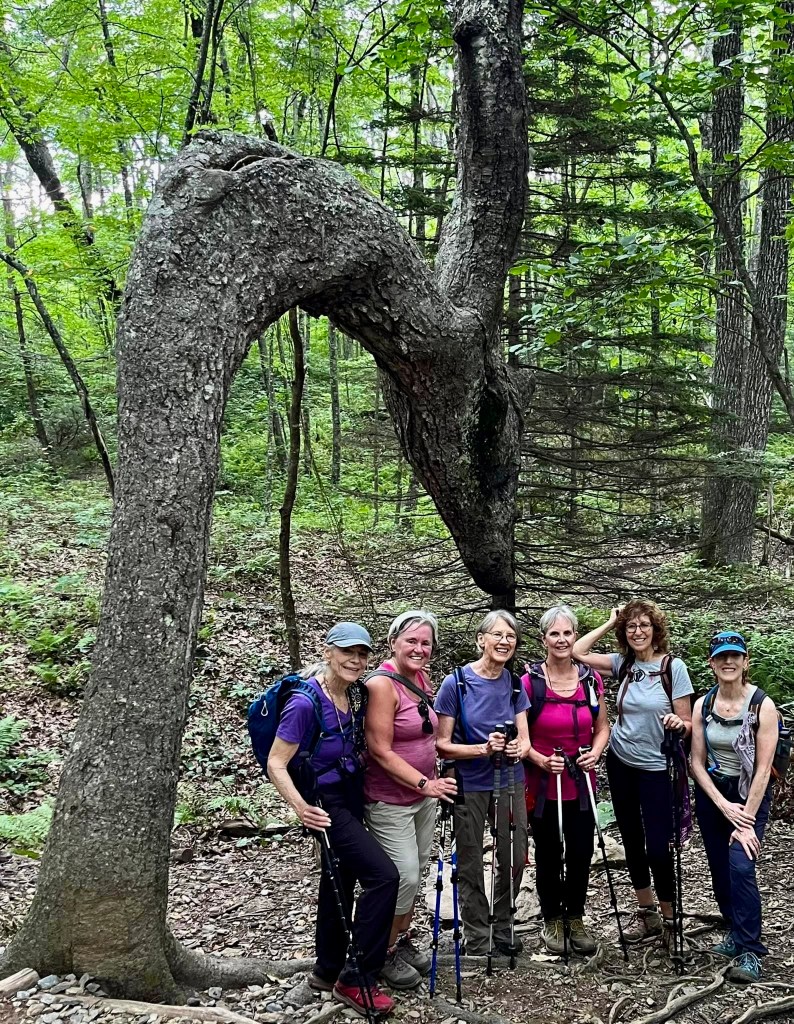
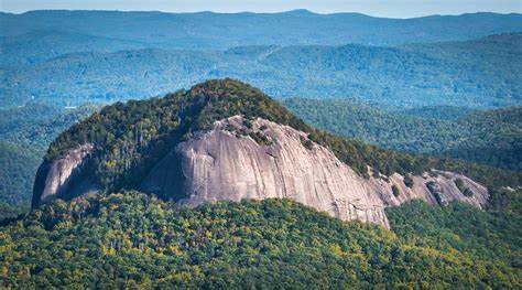
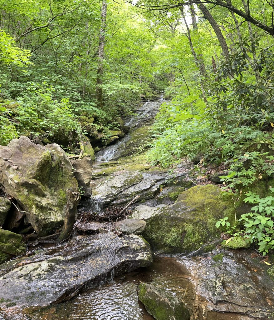
The second hike was from the Looking Glass Rock overlook off the Blue Ridge Parkway. This is the iconic monolith I climbed last week which can be seen from several overlooks on the Blue Ridge Parkway. We started on a trail to Skinny Dip Falls but cut off that trail to take the Bridges Camp Gap path to the Big East Fork River. It was a steep trail down to the place where the narrow trail levels off somewhat and hugs the side of the mountain as it follows the river. It is difficult when the trees are leafed out to get a good view of the river below the trail as it rushes over boulders and rocks making cascading waterfalls most of the way. Along the way though, there are areas where the water drops into crystal clear pools of ice-cold water inviting us to jump in and cool off. We might have done that if we didn’t have to scramble down a sheer drop off to get to the river. We stopped for lunch at a place where the trail was at the bank of the river, and we were able to stand on rocks at the river’s edge. The trail was forested with lots of Carolina rhododendrons in full bloom and lots of Dog Hobble in the underbrush. It was obvious that this trail does not see many travelers. When we got back to where we turned off the trail to Skinny Dip Falls, we decided to take the short trek over and look at them. This destination is very popular among locals and tourists alike as it provides a good place to get in the water. On our way back to our cars, we stopped to take group pictures with the very iconic “dragon” tree as our backdrop. While the 5.3-mile and 863 ft. elevation gain trail wasn’t very difficult, it was beautiful, refreshing, and a fun trip for all.
Big East Fork RiverDog HobbleCarolina RhododendronSkinny Dip FallsKristi, Wendy, Amy, me Debbie, SusanKissing the Dragon
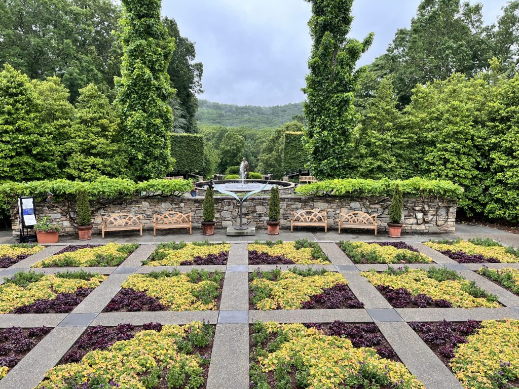
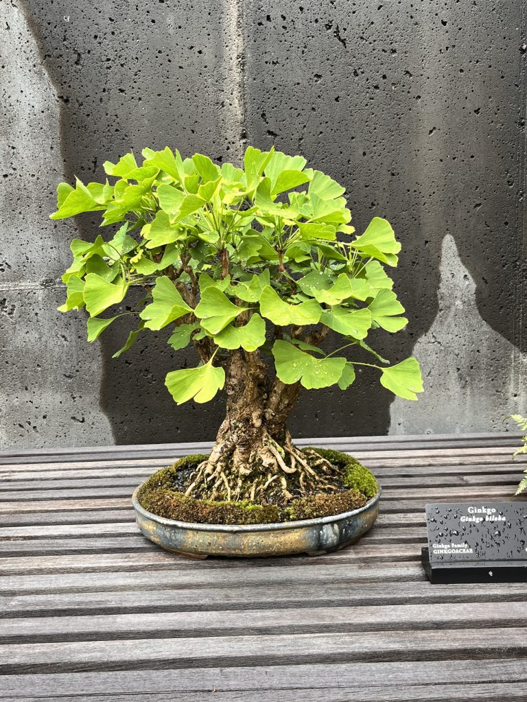
It rained most of last week putting a damper on my hiking expeditions. I did manage to get in a 5.7-mile hike with two women from my hiking group who were willing to venture out in the rain. We did a loop near my house that wasn’t very difficult but lovely, nonetheless. We concluded the hike with a leisure passage through the NC Arboretum where we enjoyed the beautiful display of flowers, plants, and Bosai trees. The dismal outdoor climate gave me a chance to assemble my gear and start the job of packing. I discovered it will be difficult to pack all I want to take in my duffel bag and keep it under 30 pounds. I still must go through it again and see what I can do without. This will be hard since I will be traversing through five climate zones and need clothing for hot to artic temperatures. I appreciated help from my friend Debi in this daunting task of getting organized.
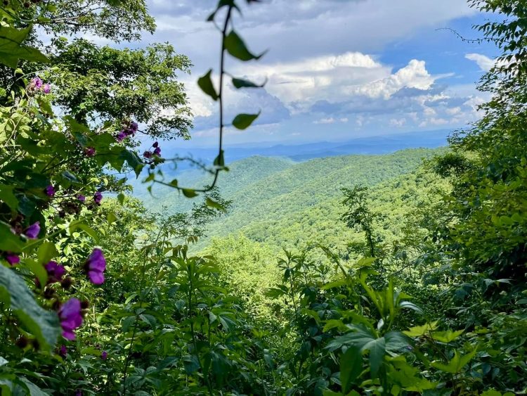
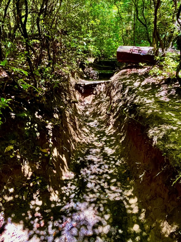
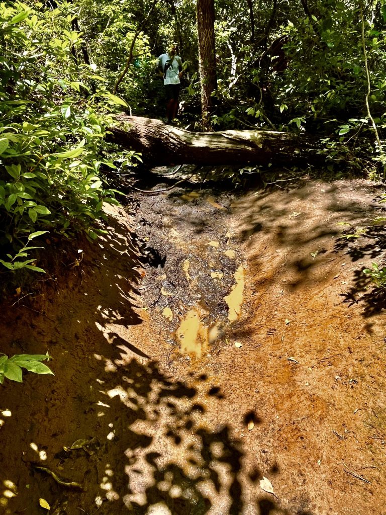
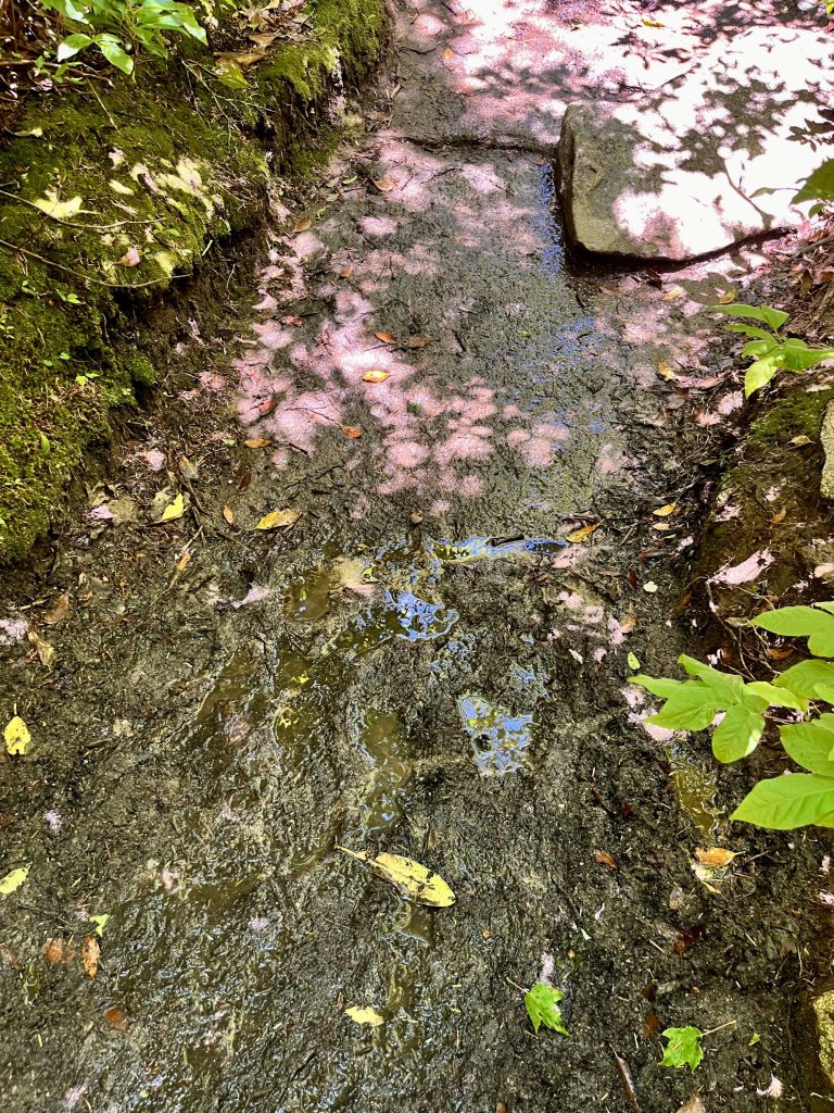
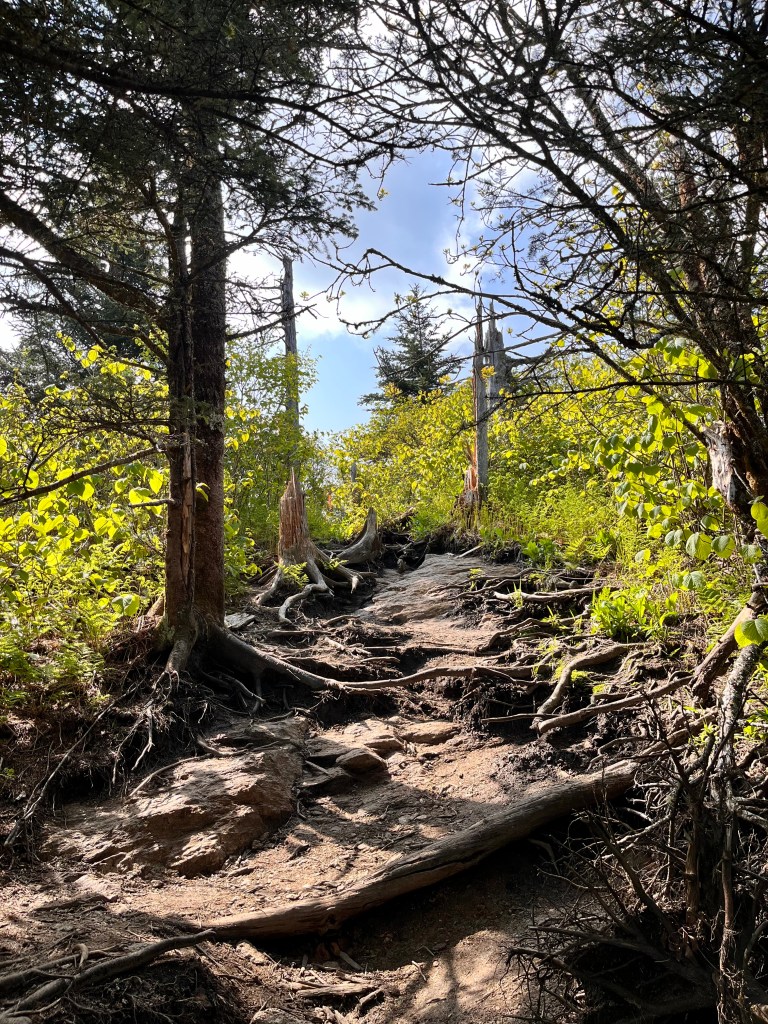
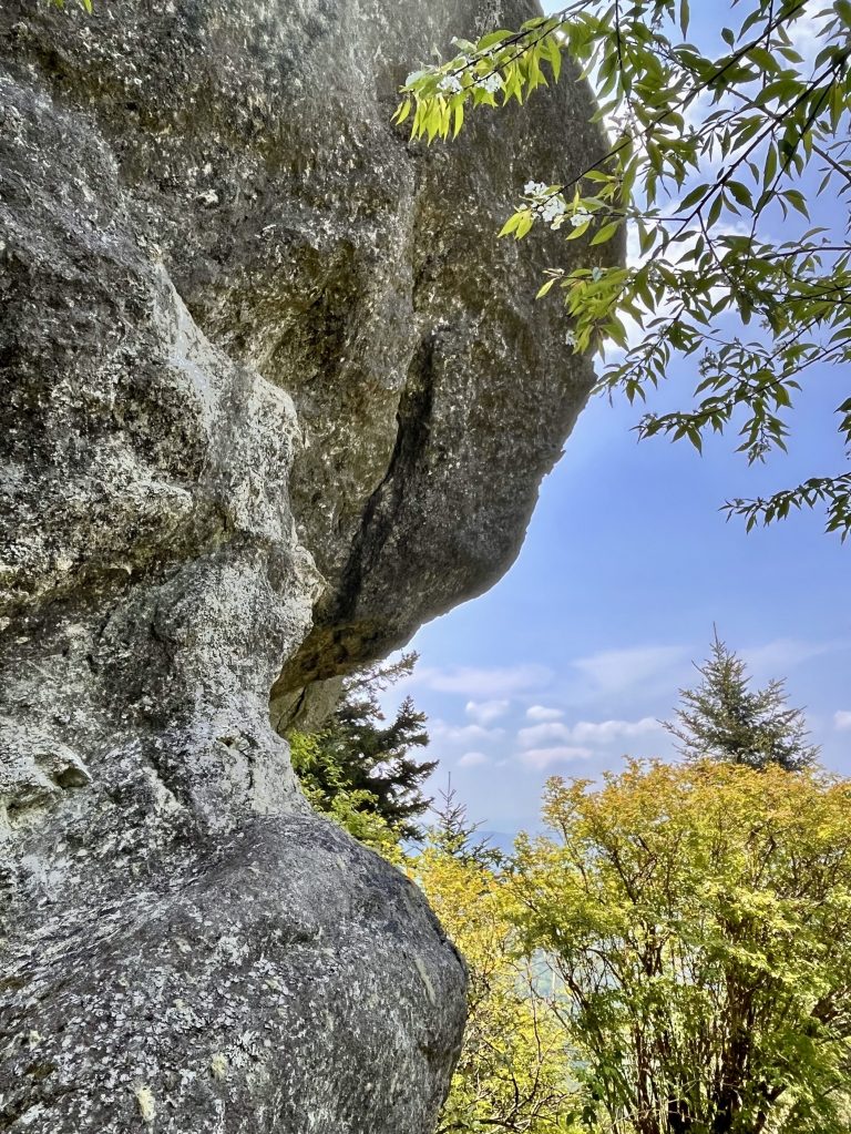
This week the weather was great, and the week started with a trek up the backside of Looking Glass Rock. It is an iconic monolith in the mountains of Pisgah National Forest. The trail starts at the bottom of the mountain and ends at the top of the precipitous cliff. The roundtrip journey was 6.18 miles and 1,713 ft. of elevation gain. I decided to use my new daypack and add things I thought I might pack in it on the Kilimanjaro climb. It was heavier than I thought it was going to be and I had to slow my usual pace down as I got out of breath much quicker. I wished I had started conditioning with the heavier pack sooner but still managed the trip in 3 hours and 20 minutes. The trail had sections that were very steep with large steps and big roots. Some of the trail had deep trenches that were very muddy. On the way to the top of the sheer rock face, we passed a large, rather flat rock place where helicopters land for rescue or recovery missions as over the years, many adventurers have plunged to their death from the cliff. Due to the rain of the previous night and the gentle breeze, the atmosphere was very clear and the views from the top of the face were absolutely stunning. No picture or video can ever duplicate what the breathtaking in-person experience provides.
Shadow art in the trail trenchSo much mudmore mudHelicopter landingKatie, Daniel Kristi,Debbie and Debi
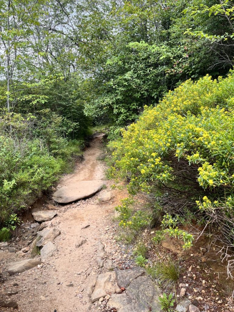
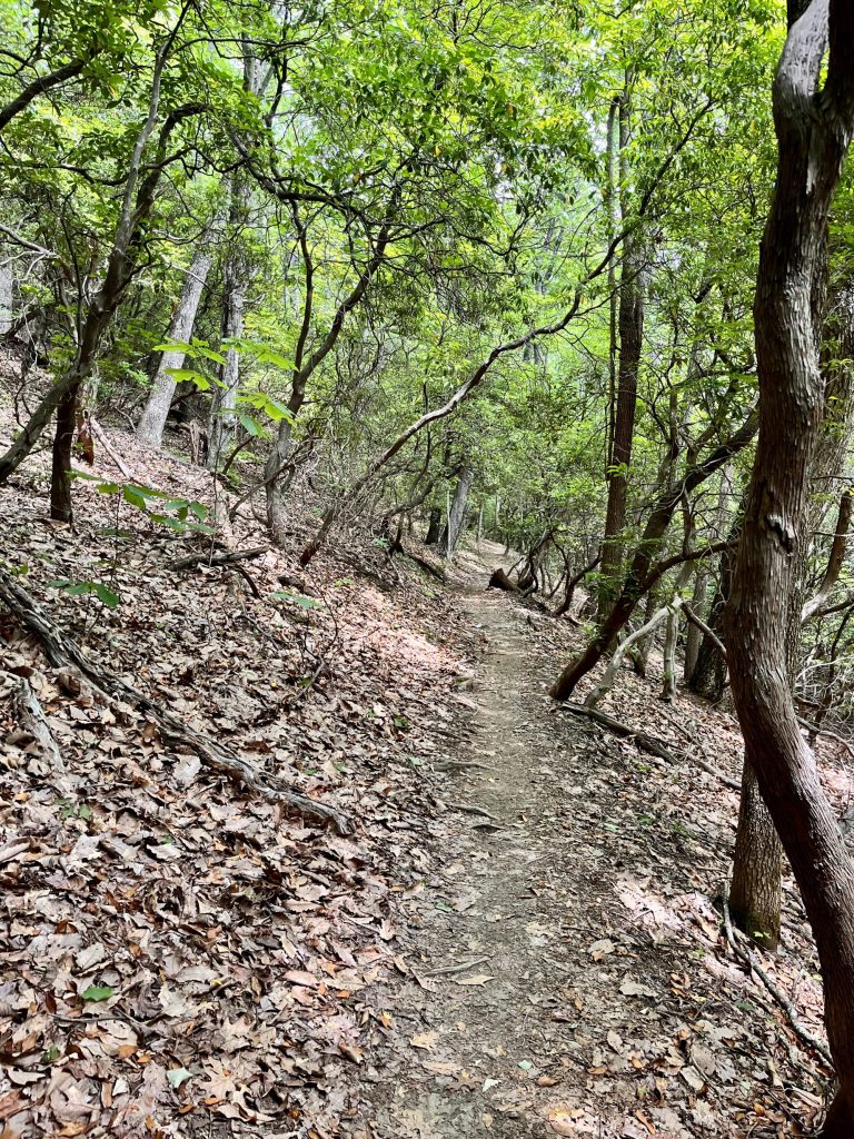
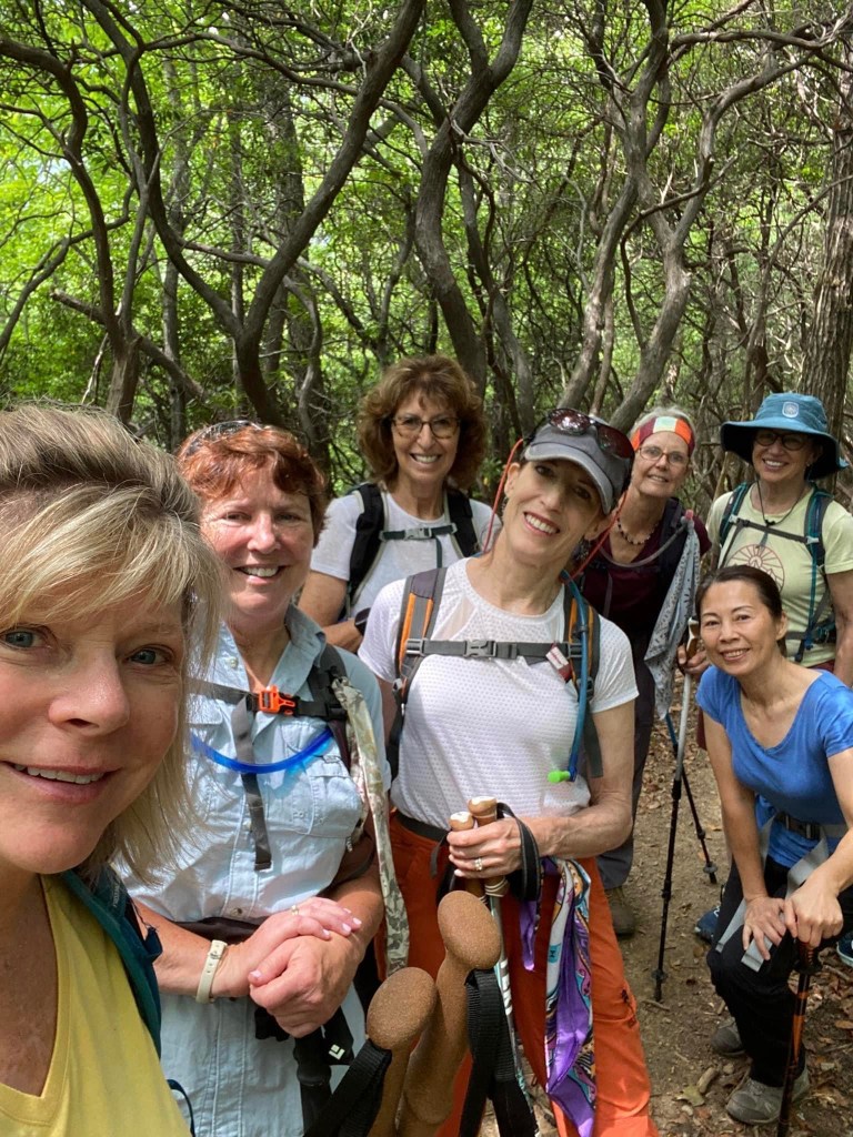
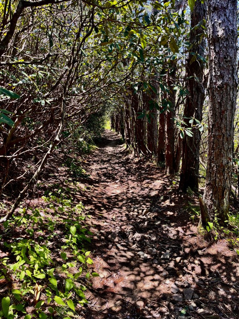
The second hike had to be adapted due to an air quality alert due to particulate matter in the air at elevations above 4000 ft. This apparently was due to wildfires in Canada. It is amazing that what is happening thousands of miles away in Canada can affect our air in North Carolina. It is a reminder of how connected we all are on this planet and how everything we do has an affect not only to us but to others near and far away. We chose to do a section of the Mountain to Sea Trail that would have a good amount of elevation gain and allow us to take a second trail to make a loop back to our cars. The terrain was the typical rocky, shady, root laden, path with multiple varieties of foliage complete with a few rhododendron tunnels we often hike through. With the trees fully leafed out, the views were mostly obscured but the flowers along the trail added beauty and interest. The group of women who hiked with me were delightful. We spent time along the way getting to know each other better and bonding over the amazing stories of the lives we have all lived. While the path of each person has been unique, we were united in embracing our differences and gaining new perspectives on life. We completed the 6.25 miles and 1200 ft. elevation gain in 3 hours of moving time. This time, I did better with the new daypack but hope to get even better before I take it on to the trek to the top of Kilimanjaro.
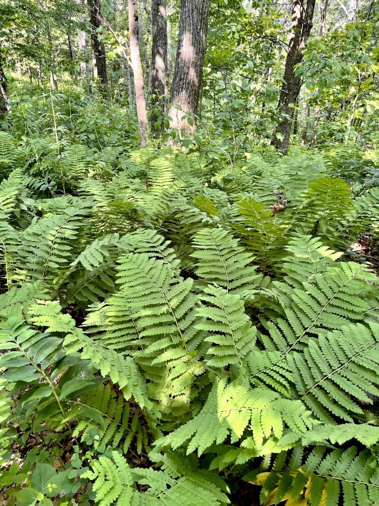
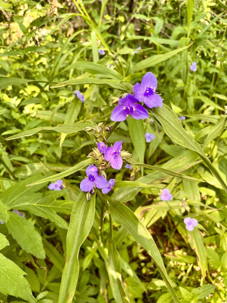
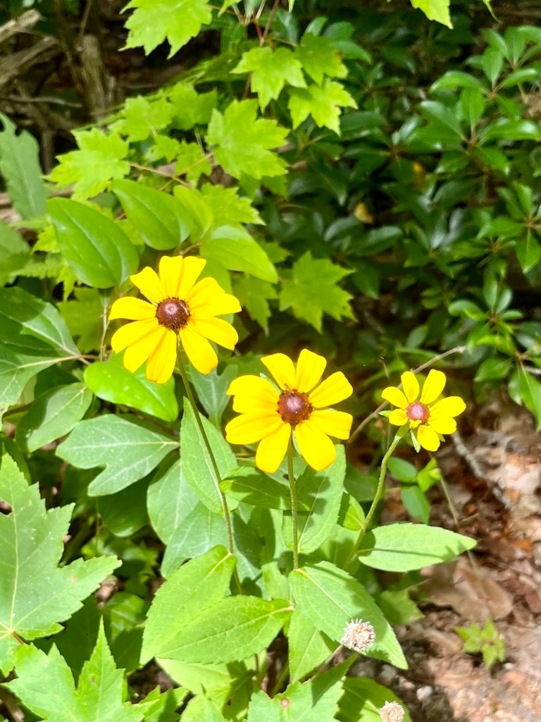
Lots of fernsSpiderwortBlackeyed susanLaura, Linda, Debbie, Susan, me, Kim, and Barbara
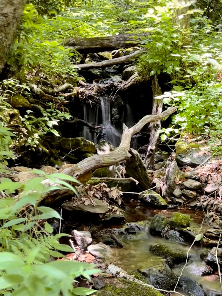
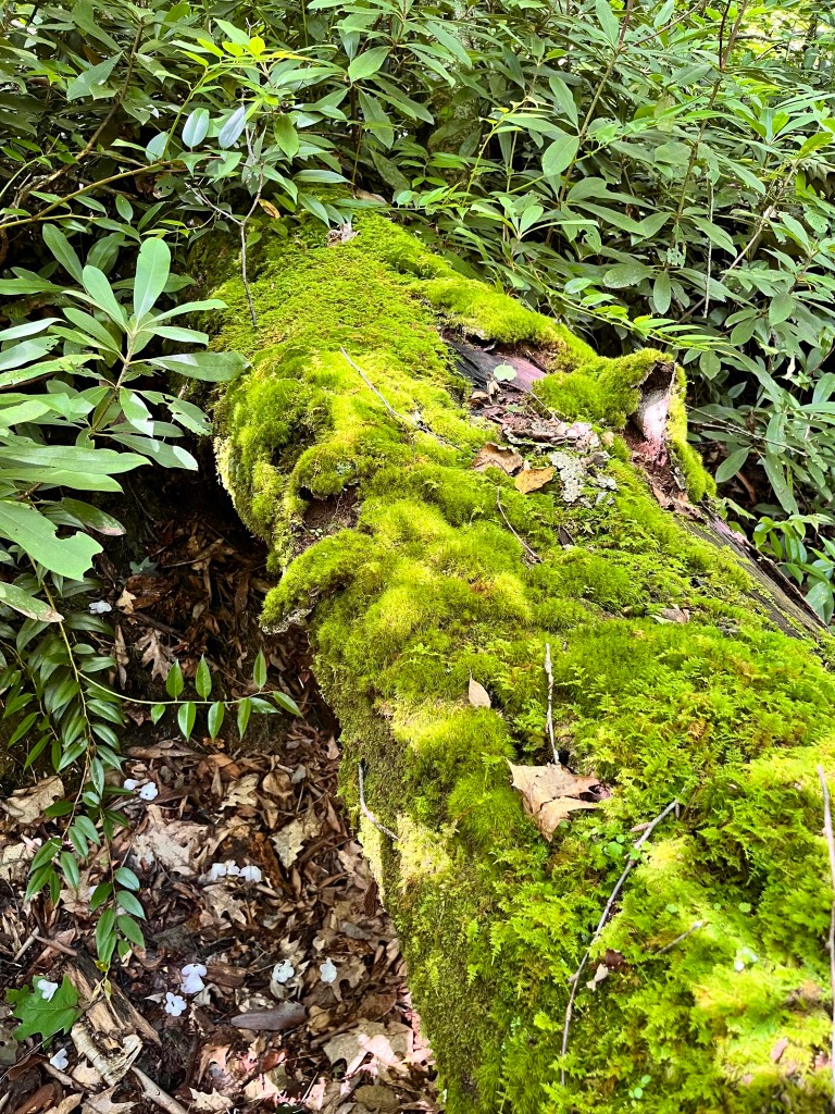
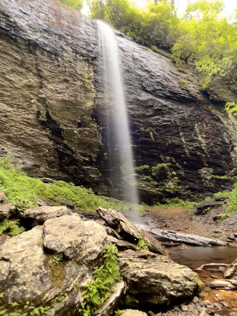
This post will cover my last three conditioning hikes. The first one was to Douglas Falls not far from Craggy Gardens off the Blue Ridge Parkway, well known for the gorgeous deep pink Catawba Rhododendrons. The 8.3-mile hike with 1,679 ft. elevation gain traversed through the densest, tropical rain forest type flora I have hiked through on any of my mountain hikes. The trail was very narrow on a steep bank for much of the distance. At times, the soft soil gave way as I stepped on the edge of the trail and there were numerous slippery rocks causing me to fall at least three times. They were easy spills so fortunately, no damage was done to my body or gear. We crossed over several small streams and one long, cascading trail of water that would have been lovely if we could have found a good place to see it from top to bottom. Douglas Falls is a straight 70-foot plunge of water onto rocks below. It is not a big, dramatic falls but worth the hike to see it, nonetheless. After taking a break in the basin of the falls, we headed back up the four-mile ascent. It was a tiring day but the beauty and invigoration were wonderful.
Douglas Falls
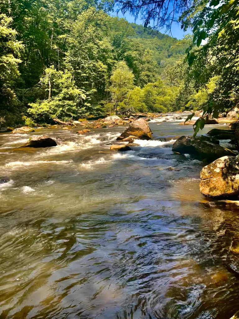
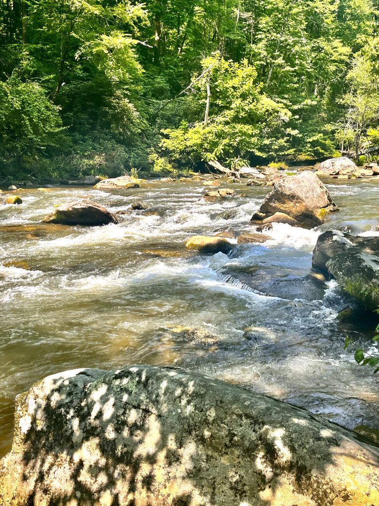
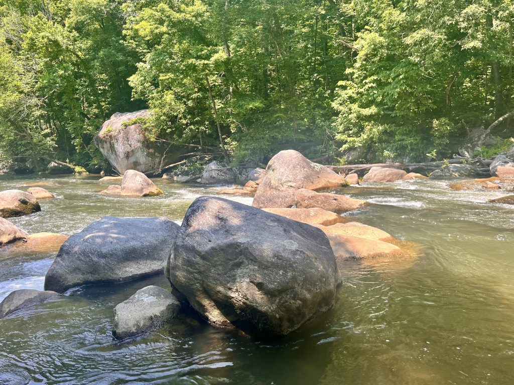
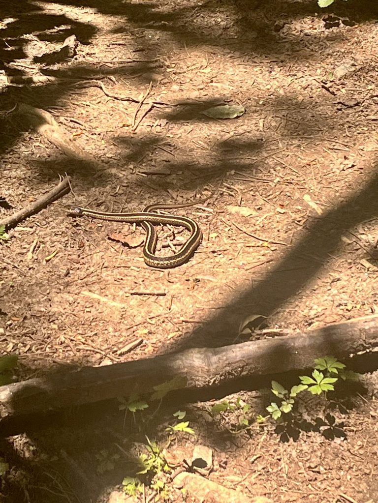
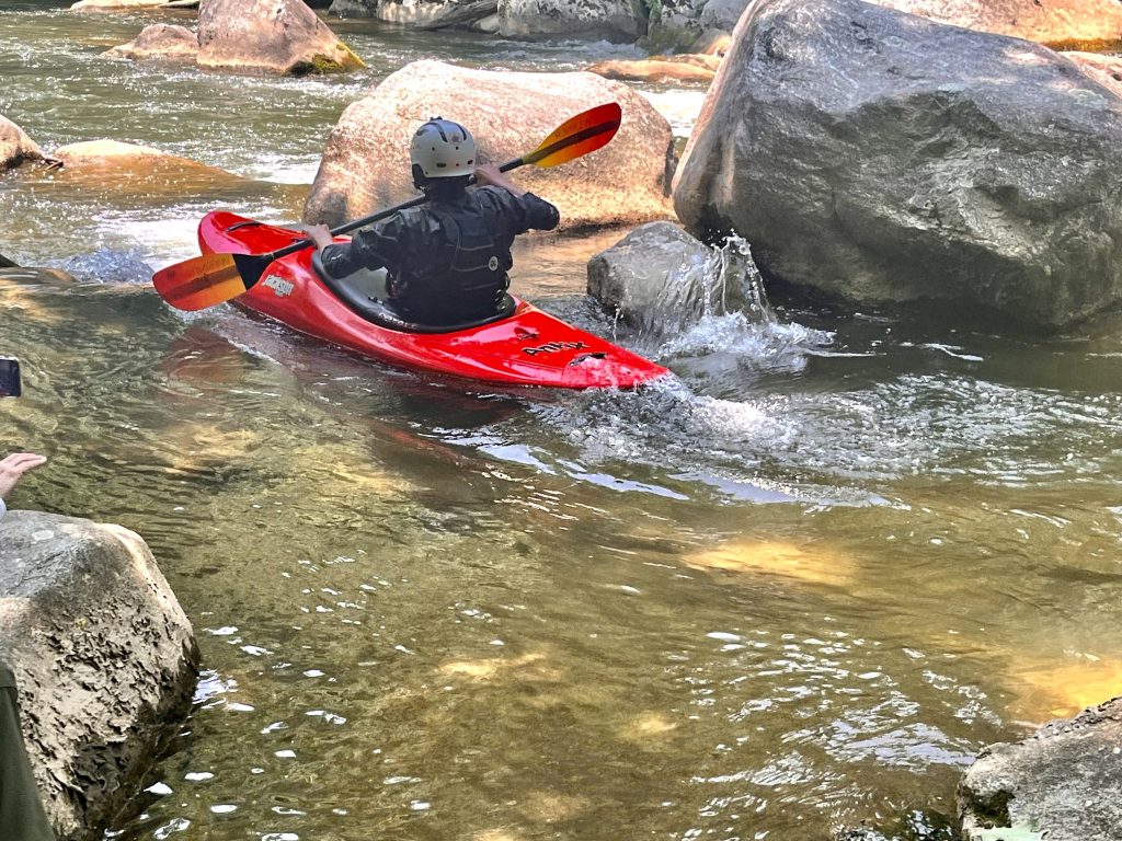
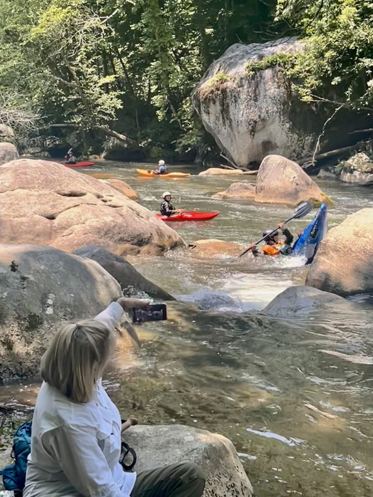
The second hike was along the Green River in the Green River Gamelands near Saluda, NC. The 8 mile and 1200 ft. elevation gain round trip trail followed the river for most of the trek. There were pretty flowers blooming along the way but lots of poison ivy too. I am happy to say that none of the hikers reported getting any reaction to it. We also had two snake sightings, one a water snake and the other a garter snake. Our turnaround point was right on the river just a little way downstream from the famed Narrows known to all serious kayakers in the area. I chose to sit on a large boulder right on the edge of the water a little distance from the others. I had a good view of a section of the water that rushed through a cluster of boulders. I am drawn to the sights and sounds of moving water, especially water that creates a dynamic force as I find it is calming and soothing. Yet just a little way upstream in the Narrows, these same waters claimed the life of the 19-year-old son of a friend and colleague of mine in a tragic kayaking accident. As I sat in silence to remember my friend’s son, I was taken with the uncertainty of life and life’s circumstances. I felt grateful for the years I have lived and once again determined to make the years remaining to be vibrant ones. I want to go places, see sights, feel the cool mist of waterfalls, and hear their roar in places I have not traveled, taste foods that bring comfort and pleasure and remember the scents I once smelled. I want to inspire others to do the same. And if possible I want to share these experiences with those I love and care about as life is better and easier when shared with others.
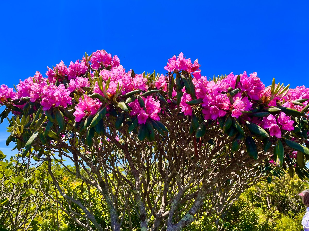
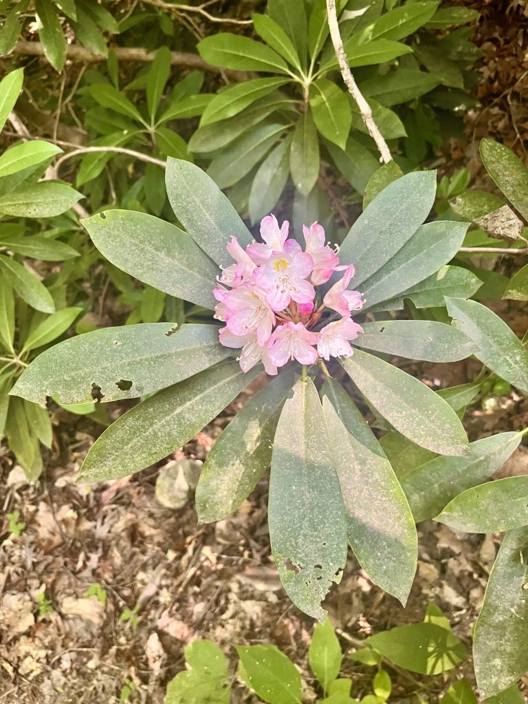
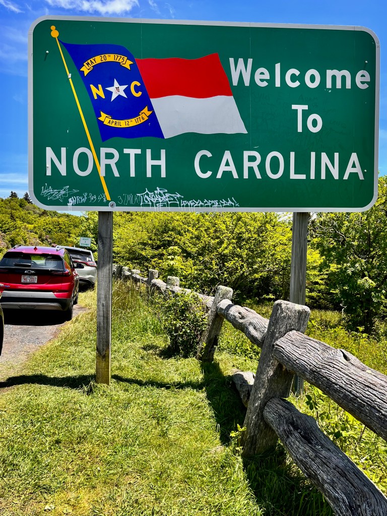
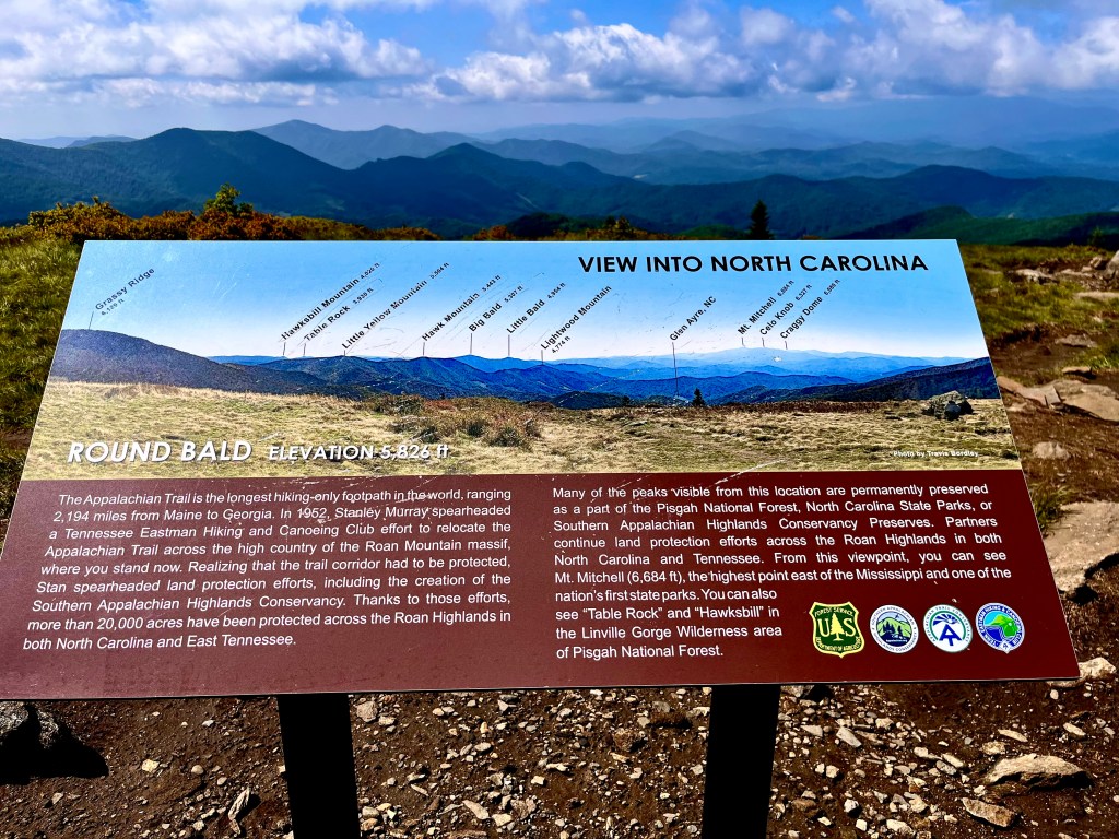
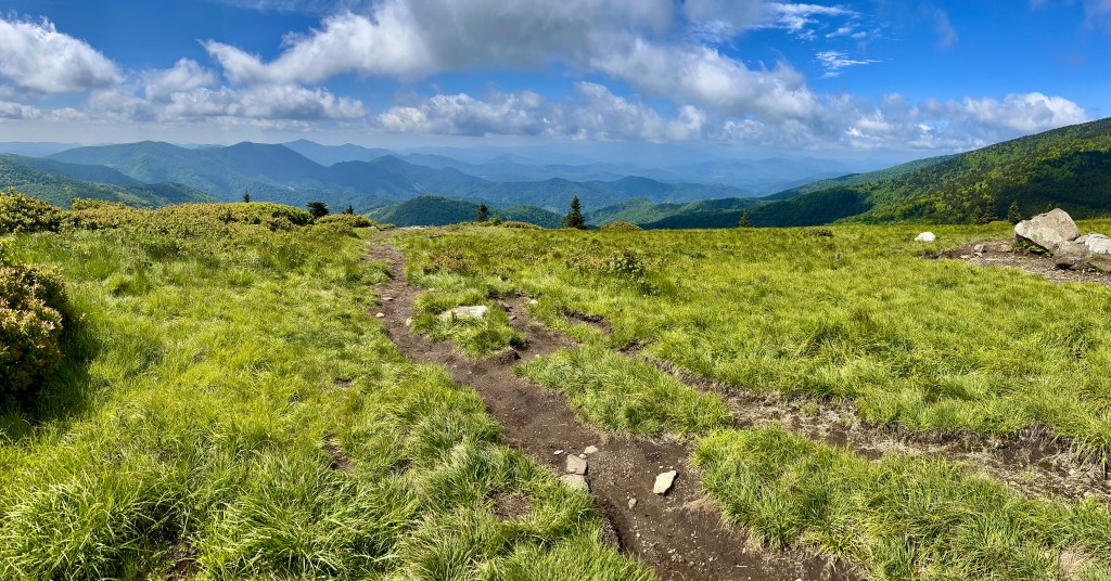
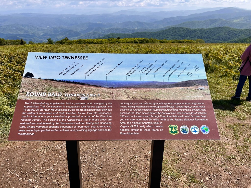
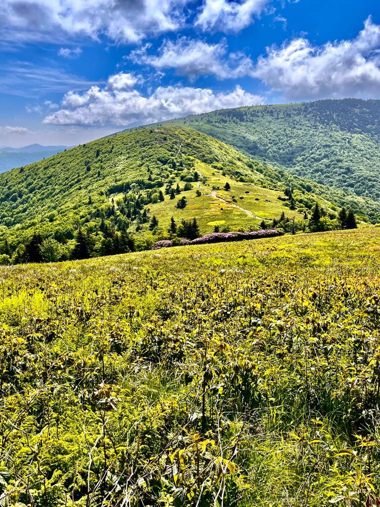
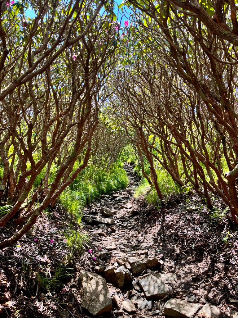
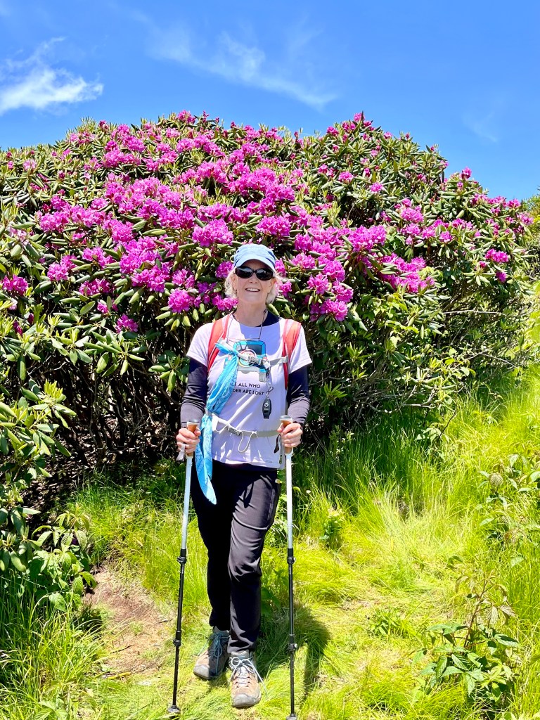
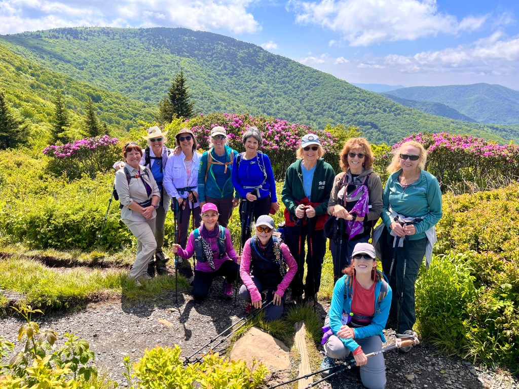
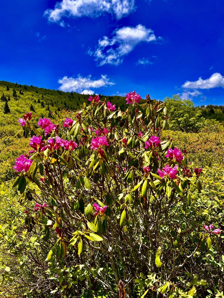
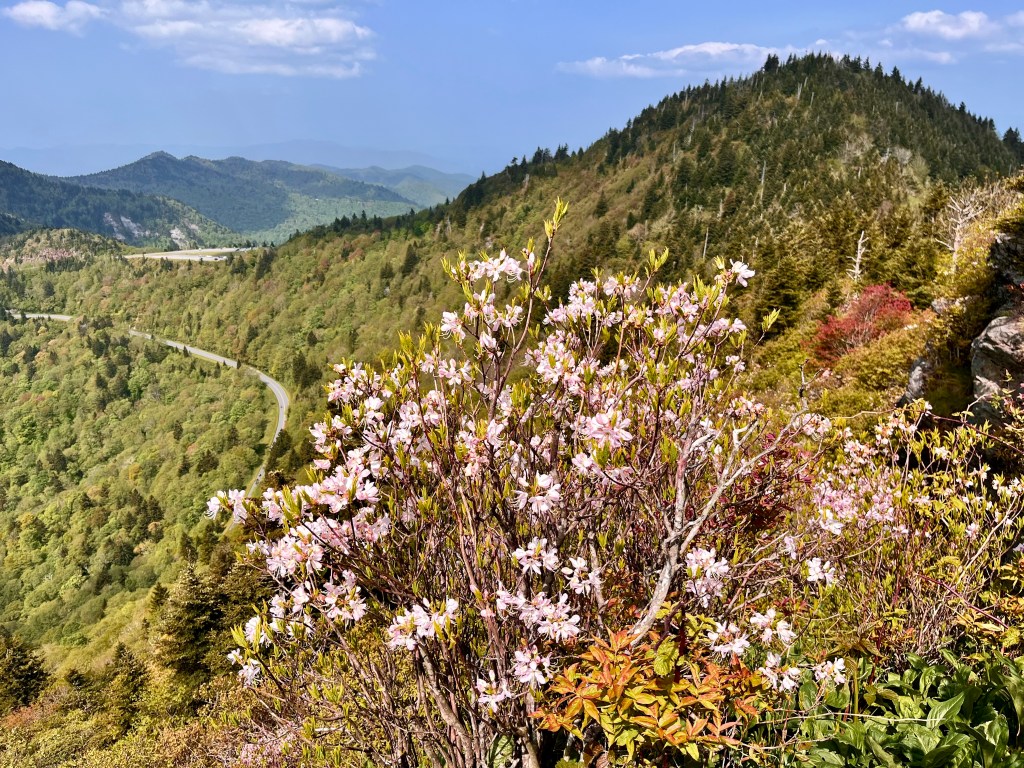
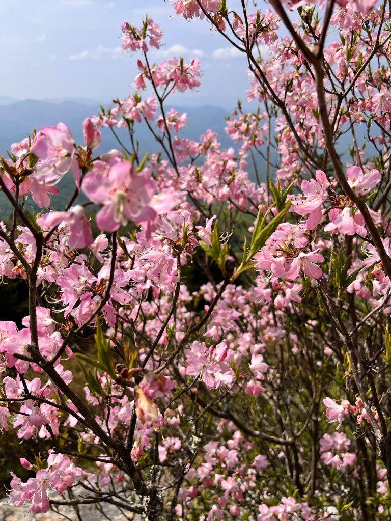
The third hike was on a part of the Appalachian Trail at a point where it crosses the North Carolina and Tennessee state line. We started at Carvers Gap and trekked to Round Bald, Jane Bald, Roan Mountain, and reached our turnaround point at Grassy Ridge Bald at 6,165 ft. elevation. Most of the trail was in the open sunshine traveling from one treeless bald to another. There was, however, a section of the trail that went through a dense evergreen forest that was dark and damp and there were a few rhododendron tunnels on the ascents to the balds. We were treated to the glory of the blooming rhododendrons that decorated the trail, mountainside, and meadows. It was hard to keep a good pace as the photo ops were abundant. The group engaged in fun conversation as we took in the grand views of the mountain ridgelines in every direction looking into North Carolina on one side and into Tennessee on the other side. The bright blue sky gave a striking background to the deep pink blossoms and the cool breeze made for a near perfect day of trekking in this grand world. As we neared the end of our hike, we stopped to chat with a local artist capturing the splendor on his canvas. As I thought back on the day, I was struck by the contrast of the dark, damp, almost eerie forest to the bright, sunlit trail full of vibrant color and beauty. While the difference adds interest, I like the sunlit section better than the dark section both on the trail and in life.
The women who hiked with me and members of my hiking group.
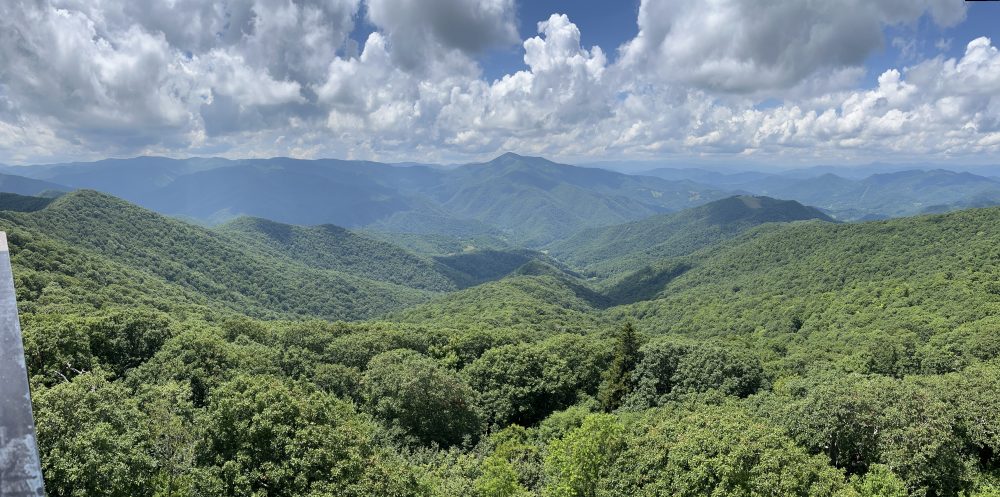
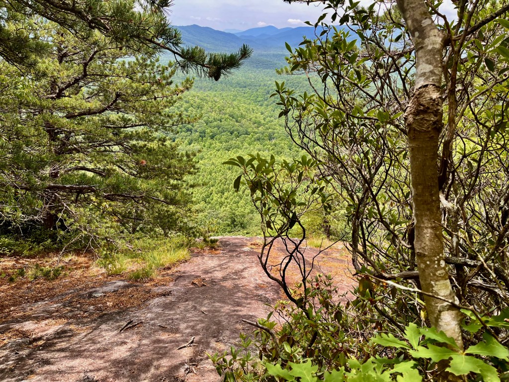
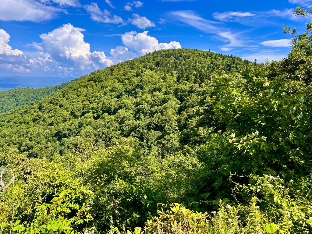
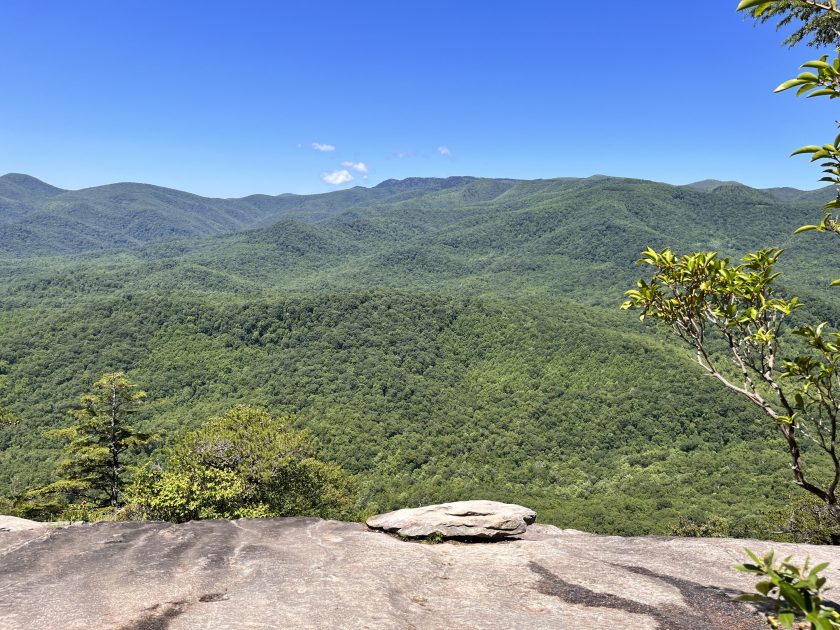
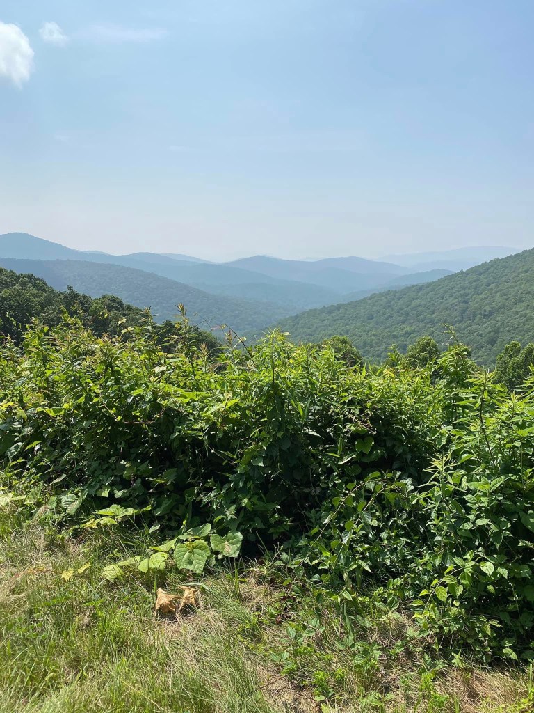
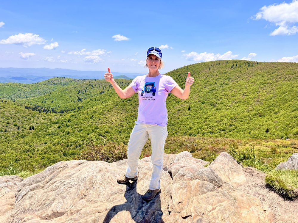
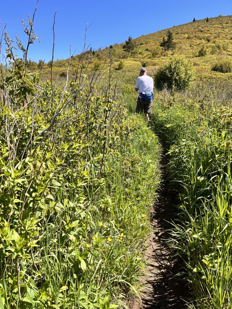
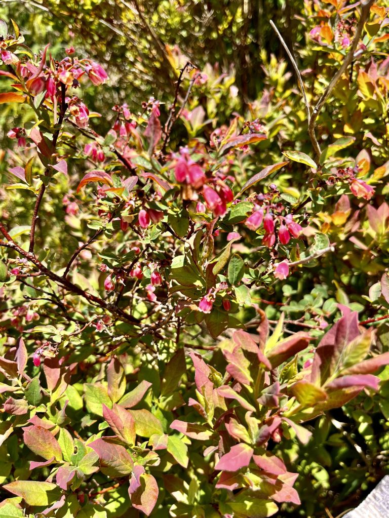
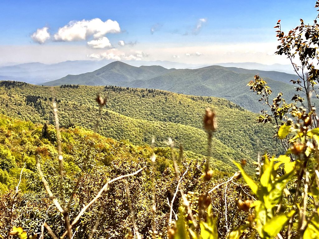
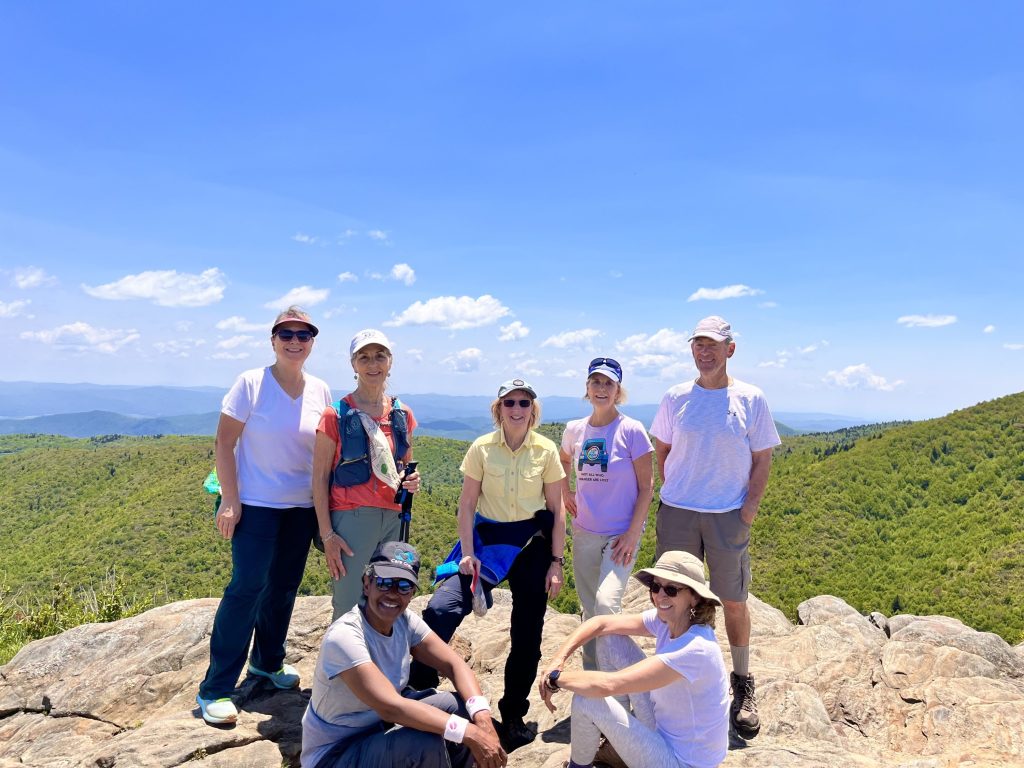
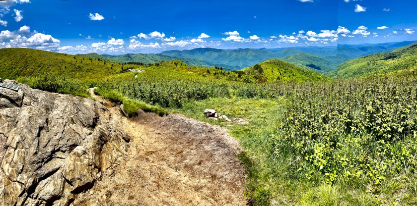
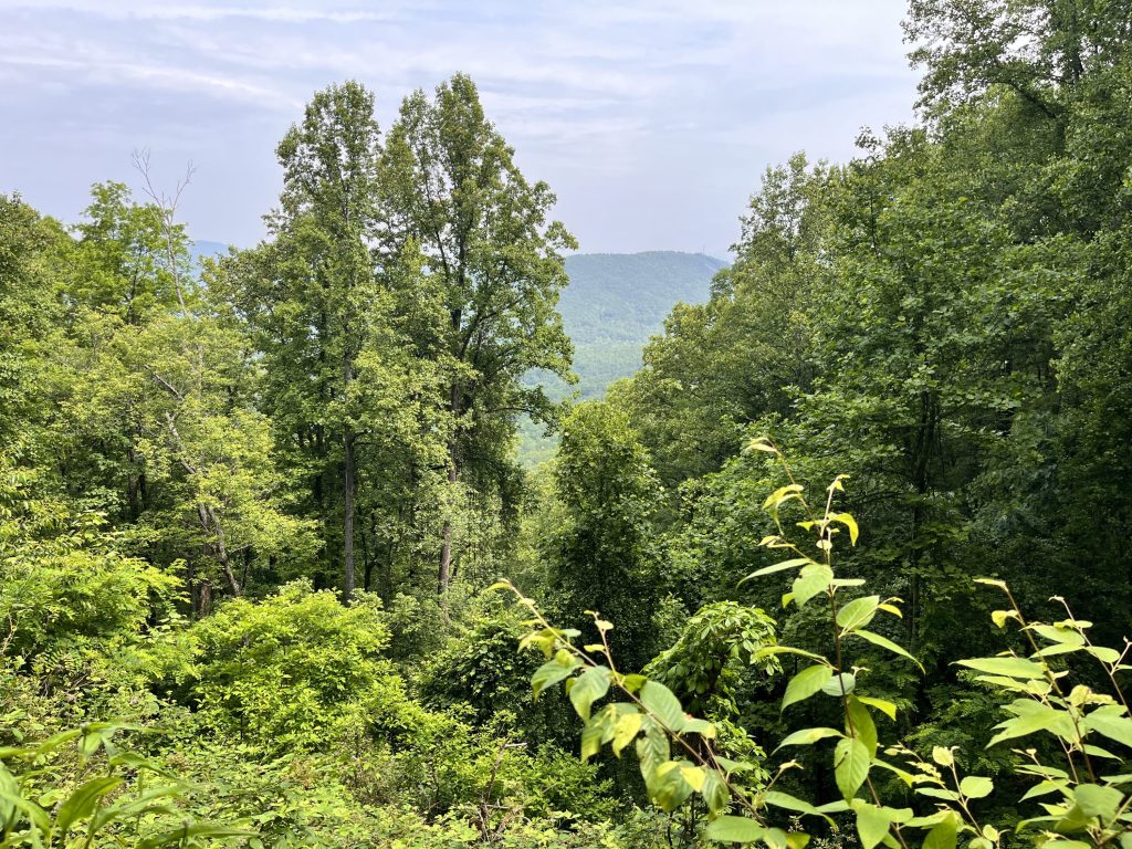
This conditioning hike was on a very popular trail a short distance off the Blue Ridge Parkway at Black Balsam Mountain. It started at an elevation of 5,650 ft. and we reached our highest point atop Tennet Mountain at 6,057 ft. Our loop started on a very rocky road that was wet and muddy almost like we were wading a shallow mountain stream. Then we left the roadway to ascend Grassy Cove Top. The trail was in full sun exposure for most of the way and the trail was like a trench that had been cut into the side of the mountain. The whole landscape was a sea of blueberry bushes with the blossoms still on the branches. There weren’t many places on the trail affording a view but the flowers in the underbrush and the occasional giant evergreens on the way were interesting. We retraced our way back to the road and took another trenchlike trail up to the peak of Tennet Mountain. This trail was also exposed to the sun but had waypoints along the trail with glorious views of the valleys and mountains beyond. At the peak there were sweeping 360-degree views of the majesty before us. It is impossible to capture the experience with a two-dimensional picture that one experiences in person. We took our time taking in the grandeur, eating our snacks, taking pictures, and chatting with other hikers also beholding the beauty. We descended off the peak and opted to forgo Black Balsam Peak but instead cut through to the road we entered on and headed back to our cars. I know that there are those who think our 6,000 ft. mountains are only rolling hills, but I challenge anyone to follow me on one of my treks up to the top of these peaks and look out to the valleys and ridgelines and then make their judgement. For me, the peaks of the mountains of western North Carolina will always be mountains that I love to wander upon.
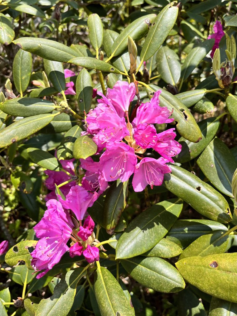
Trench like trail to Grassy Cove TopBleuberry bloomsMt. Pisgah in the distanceCatawba RhododendronsJulie, Debi, Marguerite, Diane, me, Debbie, Rich
My week started with a visit to my Movement Disorder Specialist first thing Monday morning. I met with Tyler Southern PA-C at Asheville Neurology. The semi-annual evaluation usually consists of going over my medications, discussing new issues and a brief physical evaluation that has me doing a repetoire of certain tasks like walking down the hall, touching my finger to my nose and so forth. As I completed my “catwalk” for Tyler I balanced on one foot for several seconds. I was hoping for him to offer that my balance was great but had to setttle for his “pretty good” comment. I asked for a prescription of Diamox, a medication often used to treat or prevent altitude sickness and Tyler was happy to fulfill that request.
Next stop was to an optical store to get new prescription glasses both clear and sunglasses. I wanted a place where the staff would take time to consider my needs at high elevations. The higher one goes in altitude, the more damaging the ultraviolet rays from the sun can be to the eyes as well as the skin. My research beforehand led me to The Optical Shoppe which is a family run business, and it did not disappoint. I spoke to Susan Henderson, a Licensed Optician and the Owner of the shop, who was very delightful and even offered a discount when I presented my official Team Fox letter. I decided to use my old frames and only replace the lenses. Susan made helpful suggestions and treated me with professionalism and courtesy.
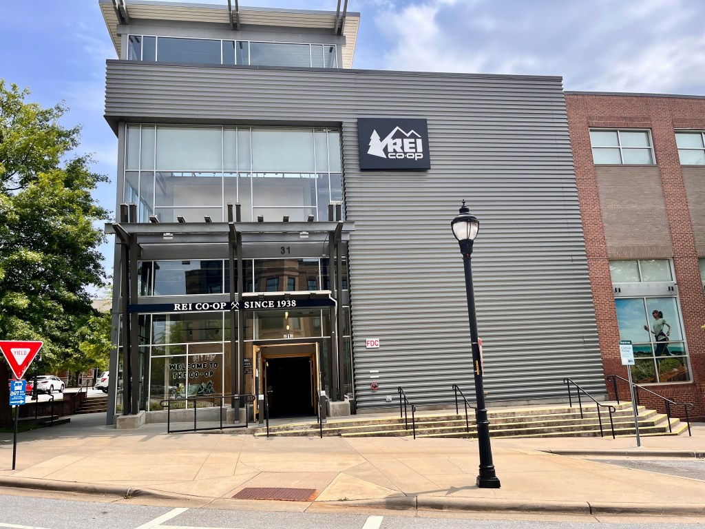
Next stop was to REI to get some of the gear I needed. The Fox Foundation sent a 2 ½ page list of equipment, clothing, footwear, and supplies needed for the trek. We will be traversing through five different climate zones and will have to be prepared for each of them. They range from farmland, tropical rainforest, the Afro-alpine moorland, alpine desert, and finally the artic zone. Since I do a lot of hiking, I have most of the things needed but still wanted to acquire a few more items. REI was having their biggest sale of the year so I was hoping Monday morning would be slower than other times and since I would be asking for help, did not want to impose an inconvenience upon the staff. I entered the store and asked to speak to the manager. Within a few minutes a friendly woman named LJ came up to me and shook my hand. I presented my official Team Fox letter and explained the purpose of my visit. I asked if there was someone who could help me find and choose the appropriate items I would need. She said that could be arranged and called a young man named Austin from the clothing section and assigned him to assist me.
Austin was all smiles and excited about my adventure. He started by bringing me an item from the Cotopaxi line. I told him I had actually been to Cotopaxi Volcano in Ecuador. That led us into a fun conversation about places we had lived and hiked around the world. He showed me different fleece pants and outer rain pants that I was looking for. He was very knowledgeable about the structure and fabric of the garments and made helpful suggestions. I settled on the ones I wanted and then he handed me off to Andre who was just as delightful as Austin. He took me to the equipment section and helped me decide on a duffle bag, new daypack with a rain protection cover, lots of snacks needed for energy especially in the high altitudes and a whistle to clip to my daypack. Then he very courteously offered to check me out at a back register, so I didn’t have to wait in the very lengthy line. The shopping excursion was a wonderful experience made special by my own personal shopping assistants, Austin and Andre.
Tuesday and Thursday were conditioning hike days. The first hike was on a trail about three miles from my house called Greens Lick. The 7.6-mile trail with 1,200 ft. elevation gain was a shaded, forested path. The Mountain Laurels were in full bloom and the trail was bountiful with glorious flowers bursting forth in beauty. We traversed over several small streams and found lookouts with beautiful vistas. The adventure was accomplished in 3 hours and 11 minutes.
Thursday I returned to Waterrock Knob with a different group of hikers to accompany me on this challenging and technical hike. Once again, the sky was blue and the sun shining. The views were beautiful as before but this time there was more haze in the air restricting the clarity of the ridge lines in the distance. There were different blossoms showing off their grandeur than just two weeks prior. The steep parts of the trail offered a good workout to all my muscle groups and challenged my balance. We visited the downed plane wreckage again and felt the sacredness of this mountain shrine to two men who lost their lives on this mountain. So, another week of getting ready has come and gone and now to enjoy a holiday weekend.
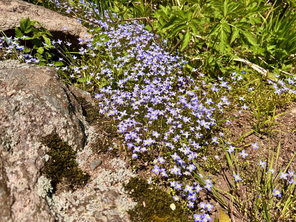
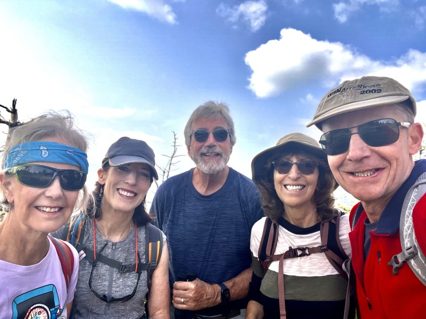
Native pink azaleaBluetsCatawba RhododendronMe with Susan, Stockton, Debbie and Mark